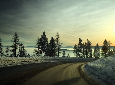
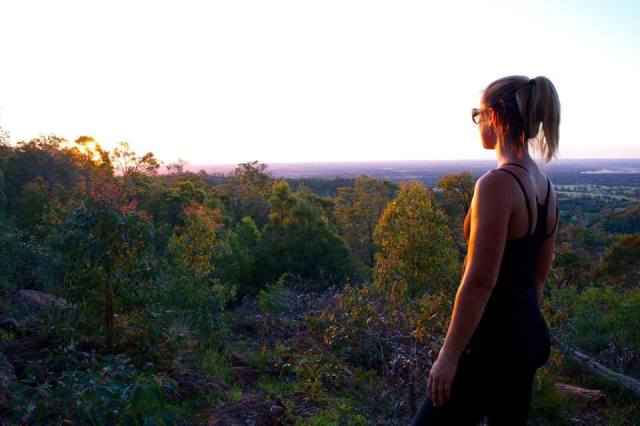
I’m about a week into my journey and have made it from Maine to Washington! The first two days of my drive around the country were strictly drive days. 10+ hours each day. I was surprised at how quickly they went though. I’ve been flying through audio books and podcasts. I drove through farm lands, old stage coach routes and of course, lots of highway. It was interesting to pass through towns that had population listed on their town signs (List Springs, WY had a population of 4!)
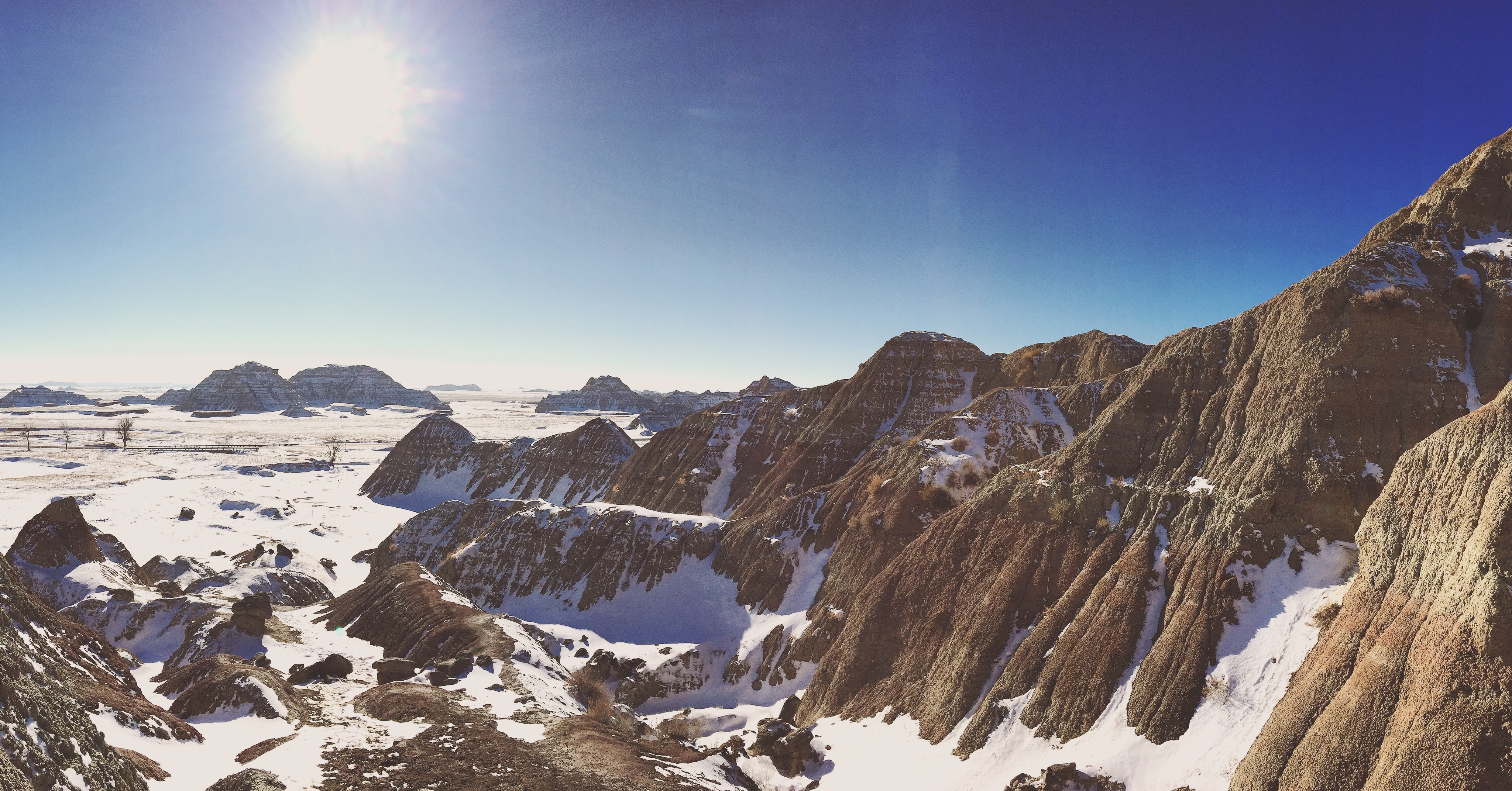
My first park stop was Badlands National Park in South Dakota. I felt like I was on another planet. The landscape was incredible!
Before heading to my hotel, I checked out Mount Rushmore as well.
I stayed in Hot Springs, South Dakota that evening – which was interesting for lack of a better word. It’s their off season so most of the town was shut down. I was one of 3 vehicles at my hotel, and when I went to a local bar/restaurant for dinner it was easy to overhear the locals’ conversations. One guy was completely wasted (at 6 pm) and the other two were having a conversation about God, sin and divorce.
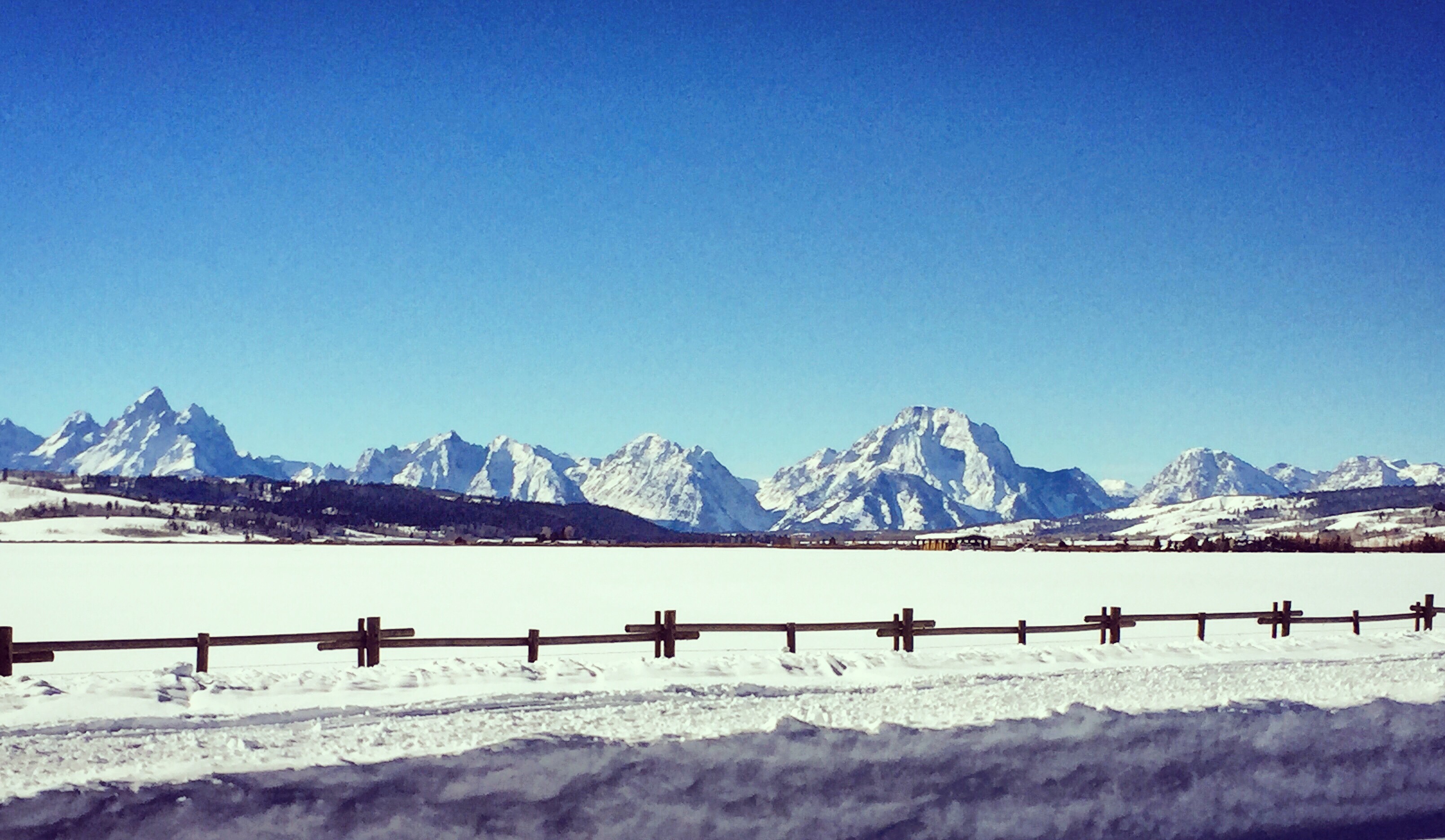
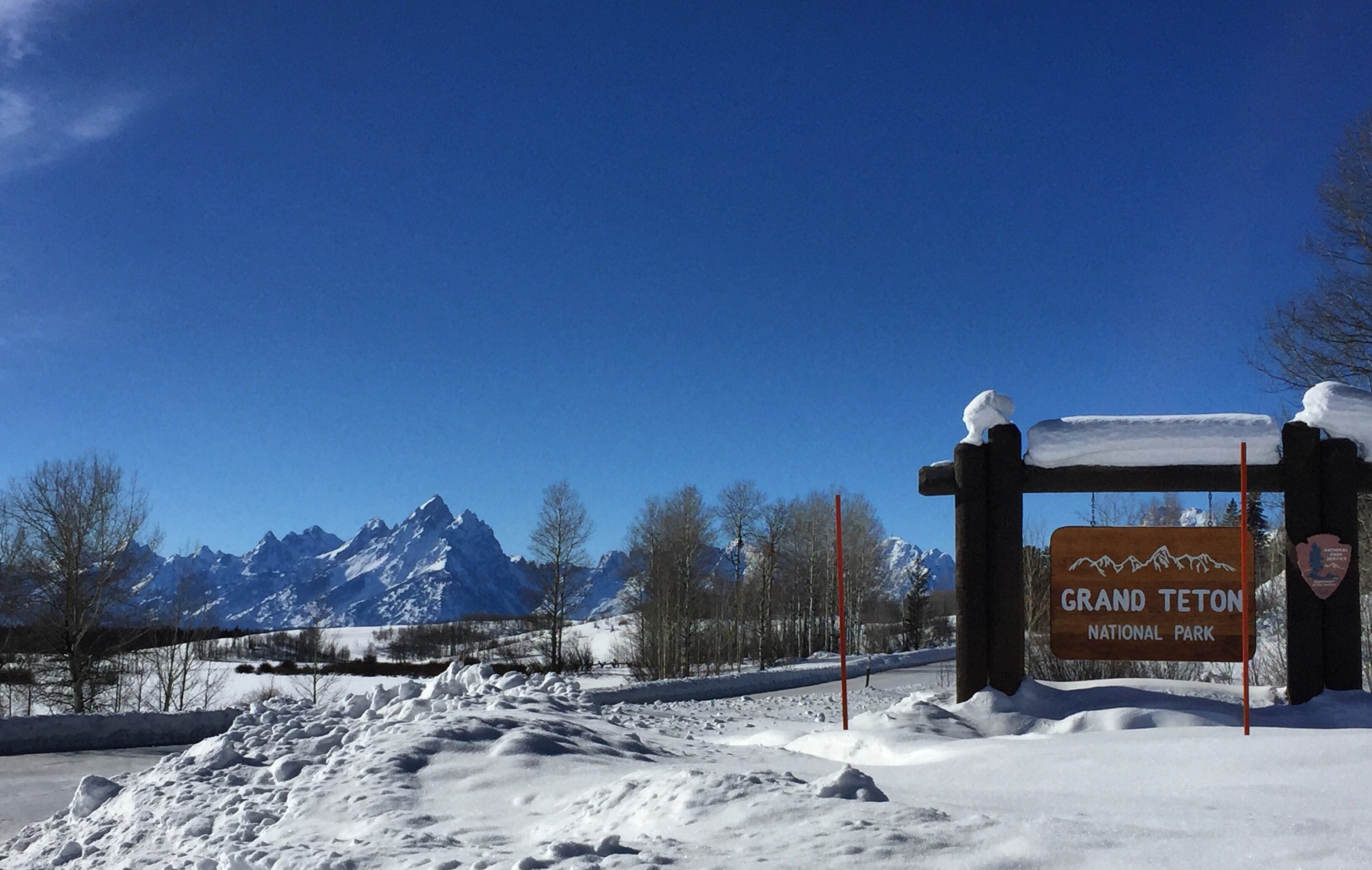
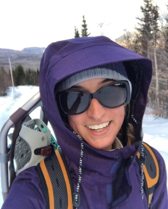
From there I went to the Grand Tetons. Pictures just don’t do these justice. When they come into view they are truly inspiring. I explored the area and woke up early the next day to head to the Glacier area. It was -20 degrees when I left!
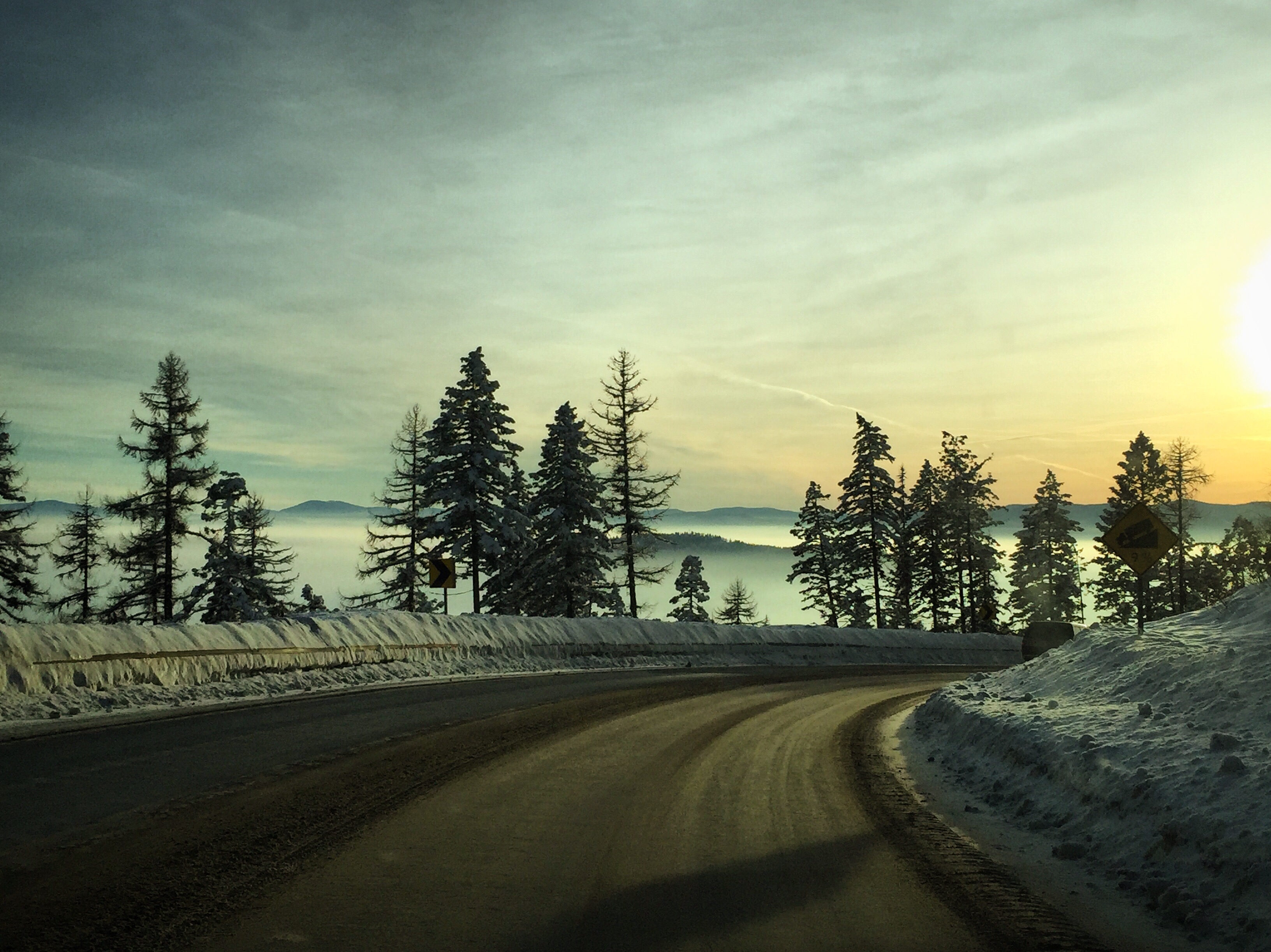
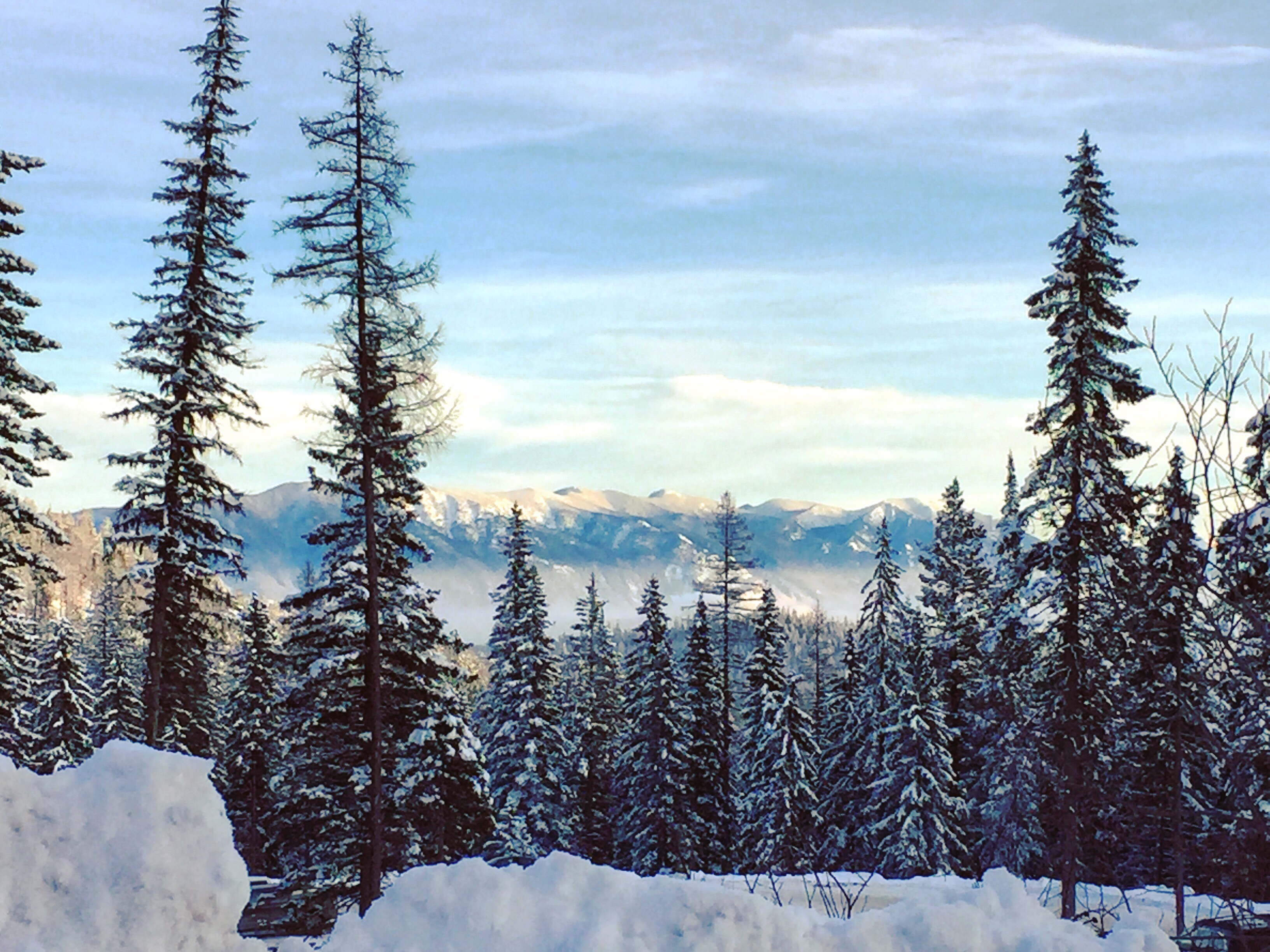
I got to the Glacier area and explored Whitefish Mountain. Stunning views.
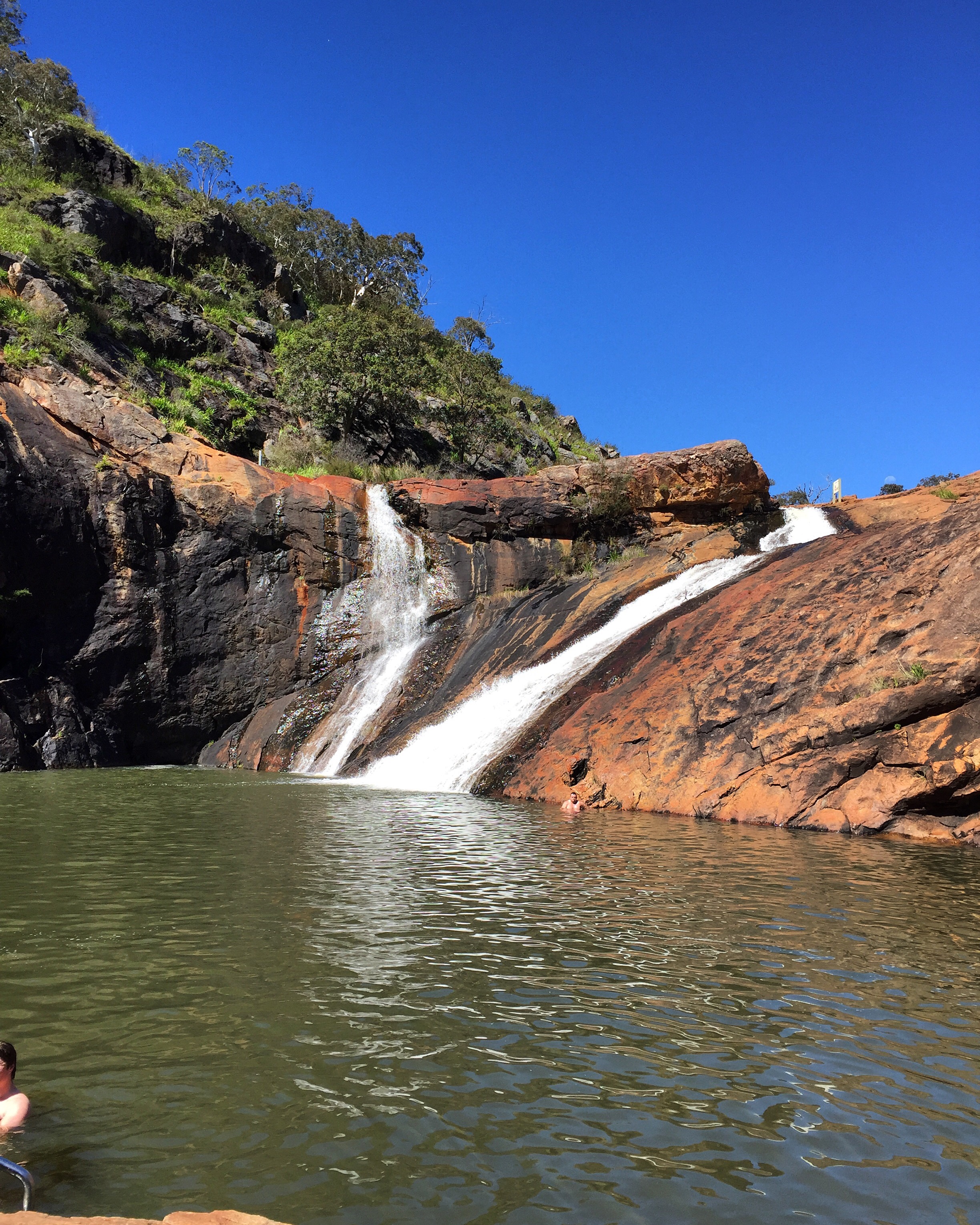
The next morning I was the first one into the park and went for a 5 mile hike into McDonald Falls. The park was amazing, even though in the winter a lot of the roads and trails are closed.
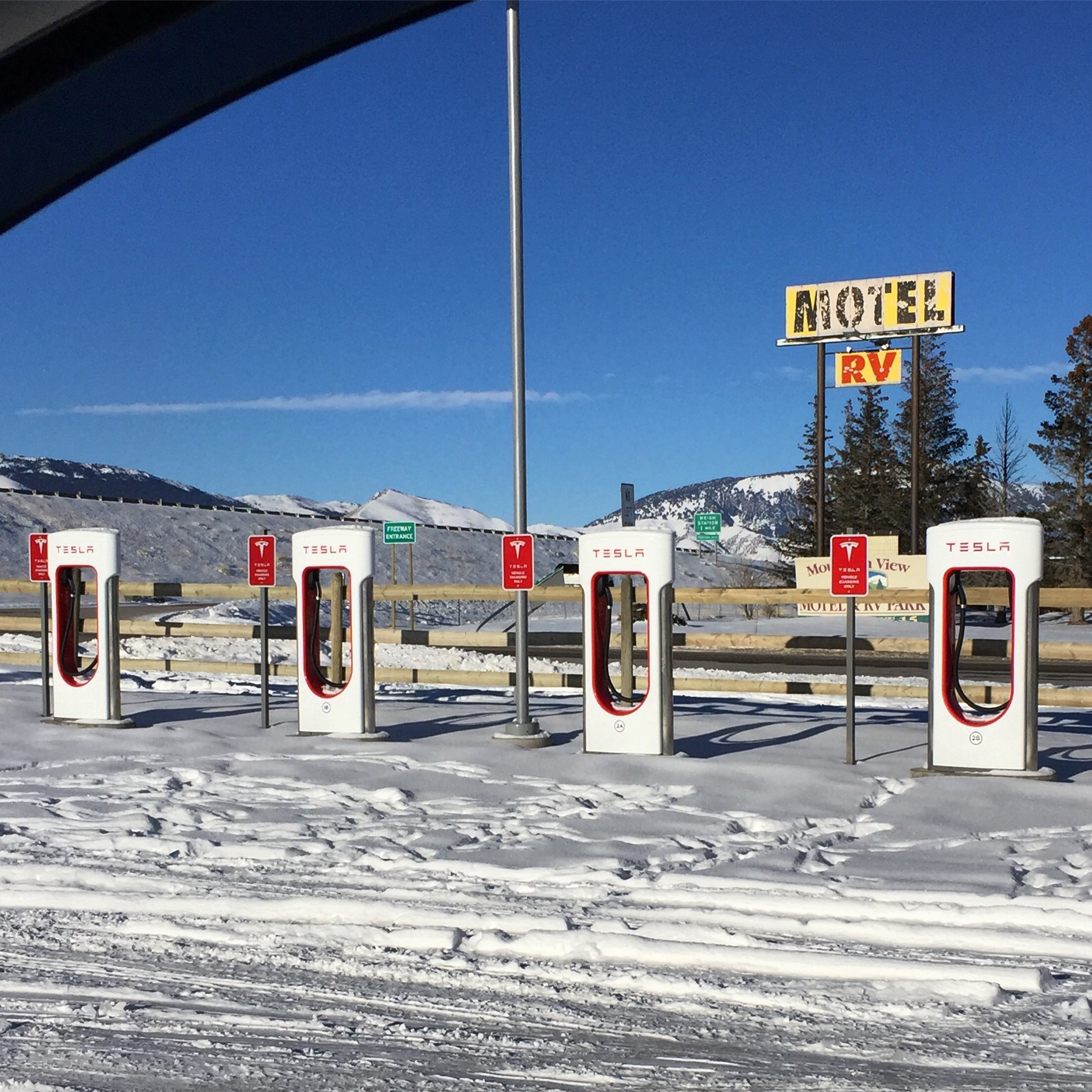
I’ve been surprised to see two Tesla charging stations.. this remote one is out in the middle of nowhere in Idaho!!! Looks like it hasn’t been used since the last snow.. at least there was one in use in Jackson Hole!
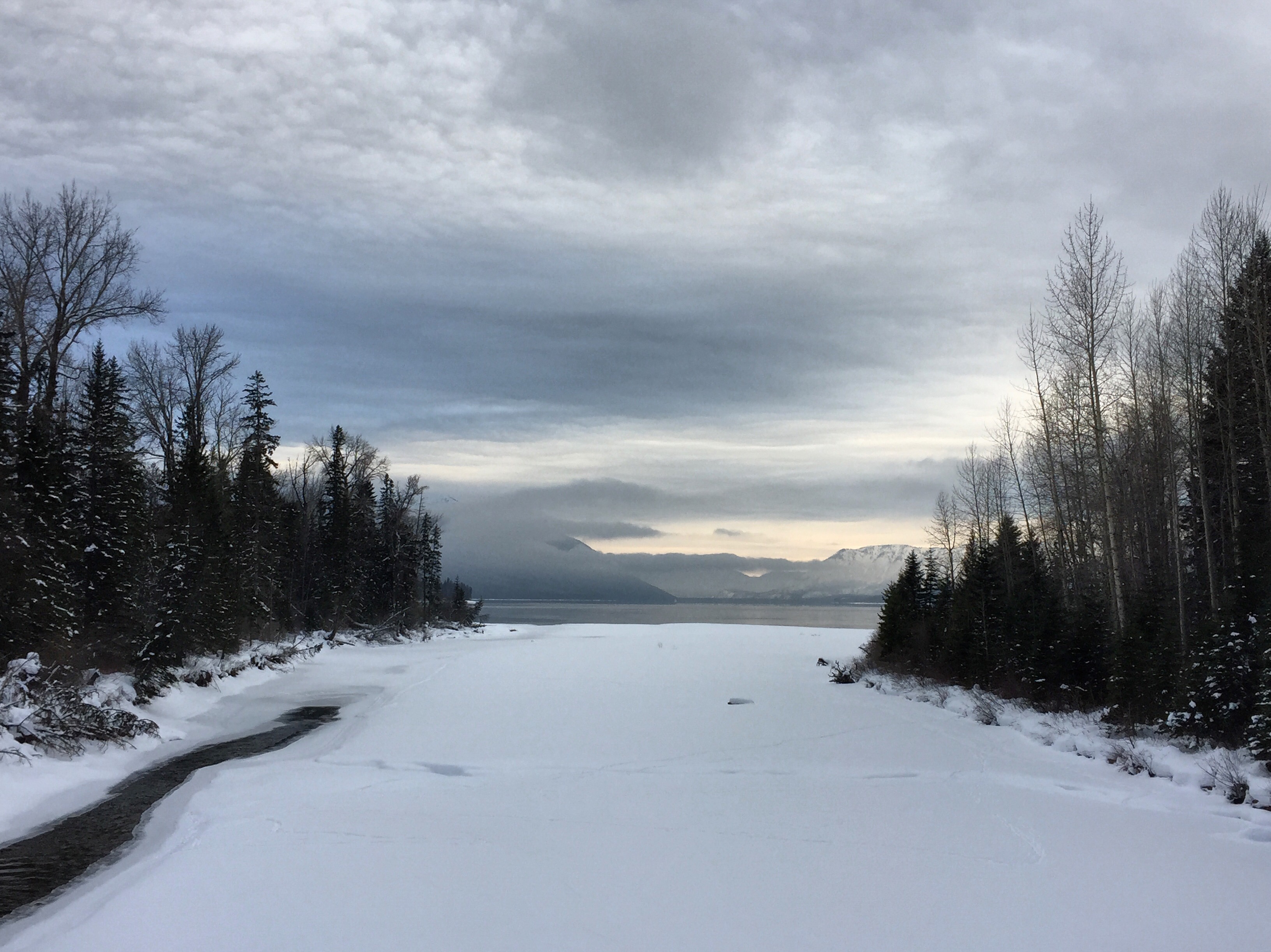
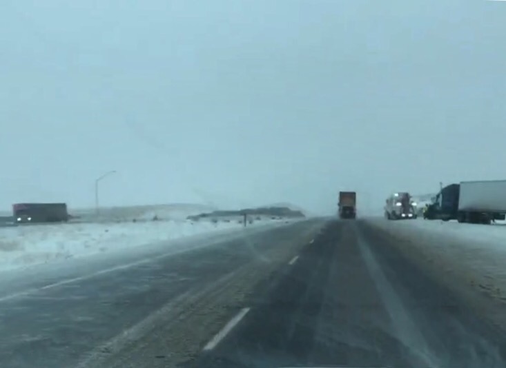
After a treacherous drive today, I made it to my sister in Anacortes, WA! I left from Post Falls, ID in an ice storm, saw about 15 tractor trailer trucks off the road before driving over Stevens Pass in a blizzard.
Tomorrow we hit the road to Multnomah Falls in Oregon!
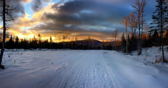
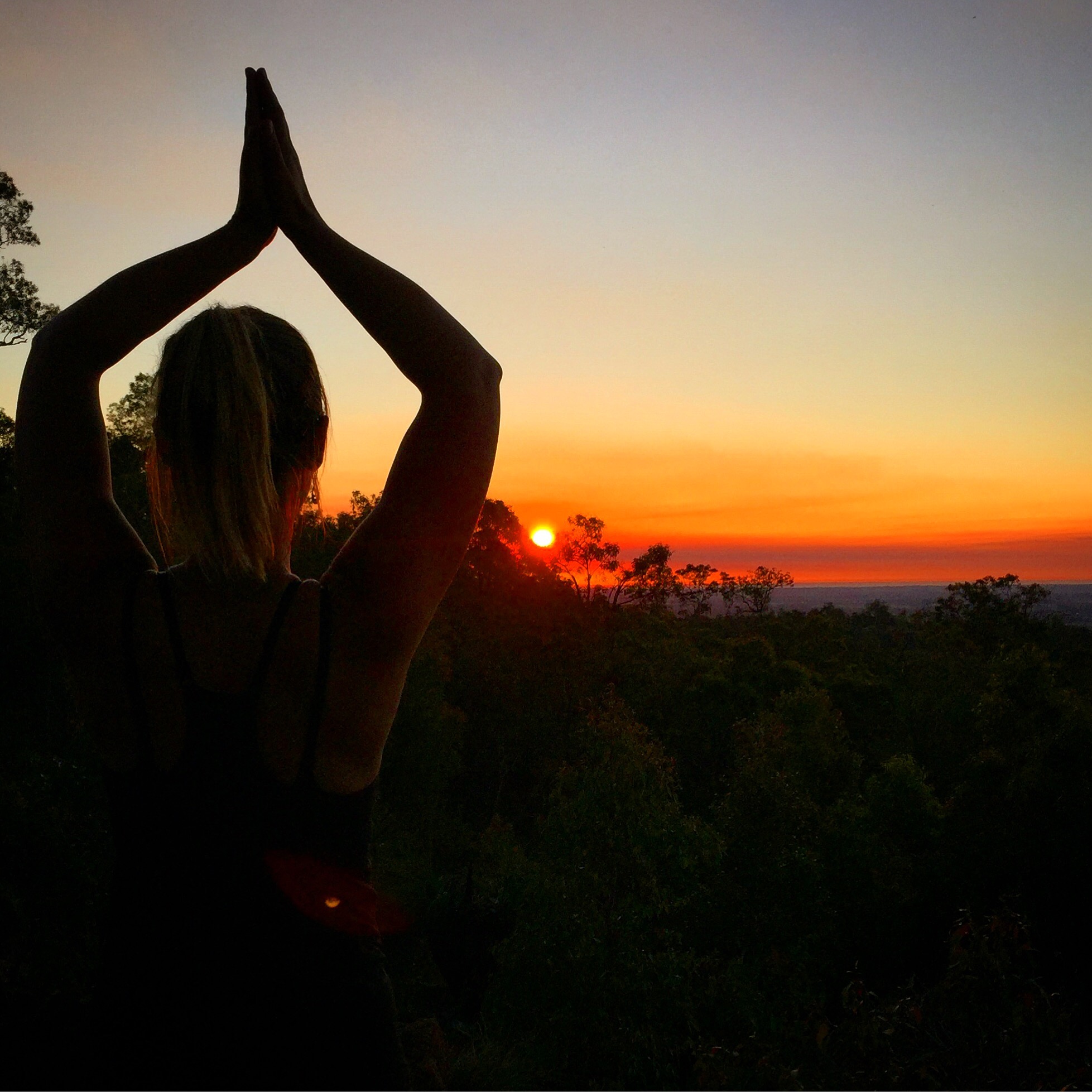
It’s been quiet in terms of travel for me over the last month – but a lot will be coming soon! Scroll down to the bottom to check out the photos of my Christmas morning hike up near Sugarloaf.
Over Thanksgiving, my family Skyped with my sister who lives out in Washington state and it was decided that I would take a road trip out there and she would join me on the return trip back to Maine! Ideally I would have done a trip like this in the summer, but timing was right so I said ‘Let’s go!’ It’s going to be a whirlwind trip, but I should be able to hit highlights from some of the national parks along the way.
Leaving on January 12th, I’ll head out to Washington and visit:
I plan to tentatively be back home in Maine somewhere around January 28th! Stay tuned for posts about this trip!
Because my family is all over the states right now (my brother is working in the Gulf of Mexico), we decided to postpone Christmas until at least my brother was home as well. So Christmas morning, I decided to hike up to the Stratton Brook Hut near Sugarloaf. It was a beautiful morning and I was the only one on the trail. I took the Oak Knoll path up, which in the summer is a mountain biking trail and in the winter it’s great for snowshoeing. It’s a little longer than the main trail, but well worth it for the views! The full hike/snowshoe was a little over 6 miles – and it was incredible.
Starting off at Campbell Field.. great view down the Carrabassett RiverI had to turn around a lot to catch amazing views like thisMade it to the hut! Inside I was the only one other than the person working. Hot chocolate and coffee!Obligatory selfie? Nearing the top after taking off my snowshoes and hiking the remaining quarter of a mile.
I highly recommend taking a hike through Maine Huts and Trails – great trails, great hikes and great views! Happy New Year!
We’ll get to that in a minute… (Scroll to the waterfall pics to read about it if you don’t want to read about the rest of my explorations).
The day after Thanksgiving I headed south in my car to Long Island to spend the weekend with my college roommate. We explored around her town as well as go back to campus. I did my undergrad at Long Island University, C.W. Post Campus. They have since re-branded and changed the name to LIU Post. It was a little scary how much I didn’t remember about campus – like where my classes were and which roads led where. It was also neat to see that people were actually attending a football game! When I was there, there was very little school spirit. And in full Long Island fashion, someone decided to bring a Hummer limo to tailgate.
Post is notorious for its mansions on campus
The view from the main classroom building
My roommate, Jessie, happens to be a huge Jets fan – and her and her husband invited me to the game on Sunday. I was a little hesitant, as I’m not a HUGE football fan and I wanted to get to the mountains at a reasonable hour that night, but when I looked and found out they were playing the Pats, I had to haha. It was a blast. We had great seats (row 4 end zone). I left a little before the end of the nail-biter game just so I could get on the road before traffic got to crazy!
Surrounded by 90% Jets fans
Our seats! Row 4 end zone!
From the game I drove a couple hours north to an AirBnB I booked in the Catskills. The following day I got up early to head to Mount Tremper and Overlook Mountain. It was a short, easy hike (my Airbnb host told me to give it 4-5 hours… I did it in less than 2), but it was beautiful at the top. I had 360 degree views of the surrounding mountains. Part way up there are the ruins of the old Overlook Hotel which was fun to explore as well!
Overlook Hotel Ruins
Views from the summit
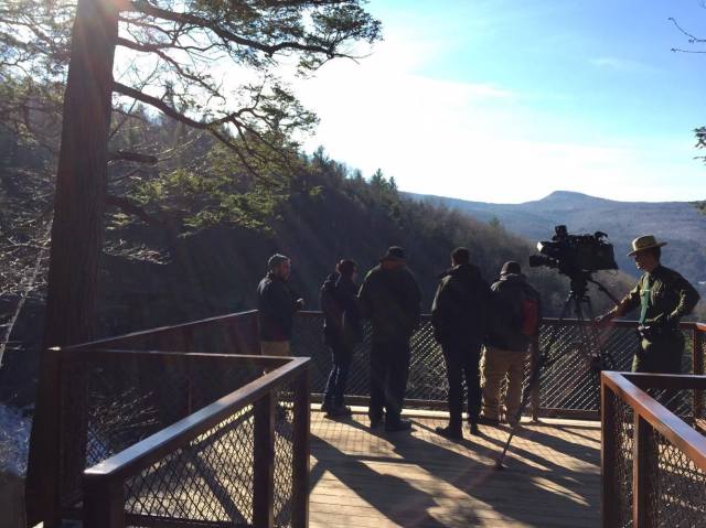
After that hike I drove a little ways to another hike at Kaaterskill Falls. I walked the short distance to the viewing platform – where they happened to be filming a section for the news. They were saying they get around 70,000 visitors to the falls each year (mostly in the summer). It’s a two-tier falls that cascades over 250 feet total.
News crew filming!
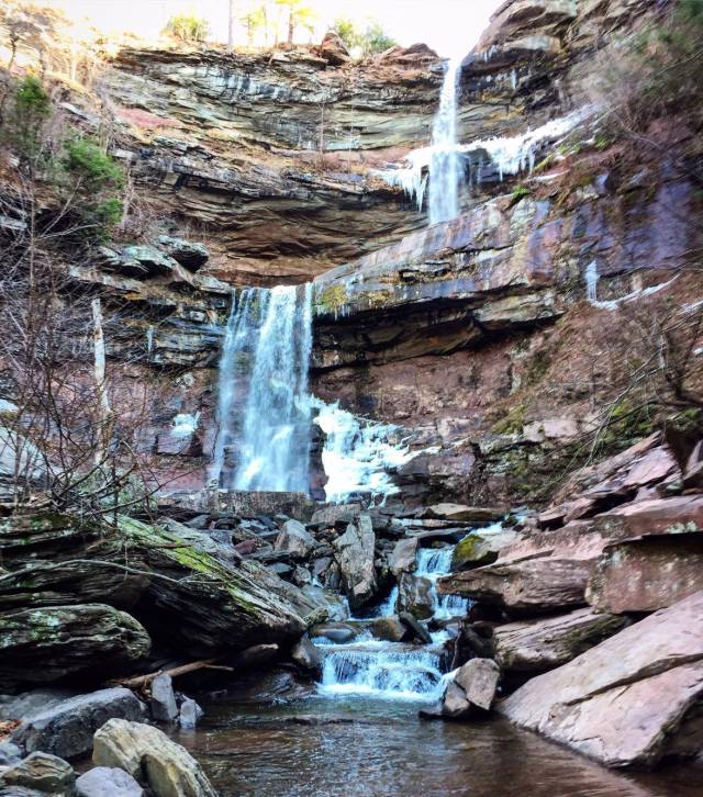
From there I did another short but more intense hike to the lower section of the falls. This is where it got interesting. The ground wasn’t frozen and there wasn’t any snow, so I didn’t have my spikes on my boots (but they were in my pack). As I got to the bottom of the top tier of the falls, the path was clay and I followed that to get a view at the base of the falls. What I didn’t see, was black ice as I rounded the corner. I immediately fell and was sliding on my hands and boots (with really good tread) down about 4 feet until I was about a foot from the top of the second tier of the falls. I starfished and my feet found a couple small rocks to grip (literally 4 inches wide by about an inch high). I thought for sure I was going to go in. I have never really been scared that I was going to get hurt or have a major mishap when traveling – this was a first for me!
From the base of the top tier – where I almost went in. Worth it!
From there I hiked down even further to get a view of the entire falls. A guy was down there and had seen my slip and told me that he thought for sure I was going in!
The full Kaaterskill Falls – it was gorgeous! The ledge the slants down to the left in the middle is what I slid down.
After grabbing lunch, I headed to a mountain drive that I heard was good for sunsets. It was a seasonal road, so I said what the hell, I have a Jeep, I can give it a shot. There was some snow on the road, but you could see where another car or two had passed previously so I headed up the road. I get near the top and I happen upon a young couple with their Subaru Impreza stuck in the ditch. The had slid off about 50 feet up and had worked their car down the ditch trying to get it out. I offered my assistance – pushed, drove the girl to the store to get some kitty litter (helps on ice!) but it was just too stuck. We were able to find a place with cell service (service in the Catskills is slim to none) and she called AAA. I figured I probably shouldn’t push my luck after nearly falling into the water earlier, so I headed back for a relaxing night at my AirBnB.
Unfortunately, the next few days were all rain so I took my time working my way through Vermont and back home. Now, I’m up at Sugarloaf crossing my fingers that we get a lot of snow in the storm tonight!
I’ve been home for about 2 weeks now, and though I’ve been silent on the blog front, there has been a lot going on! Those who follow my Instagram account (amyirish1) may have seen some posts from recent hikes. In addition to those, I’ve been thinking about and trying to figure out my next steps.
I’m going to stay in the New England area through the holidays…and go to warmer climates and get my scuba certification in January. So until then… I need to find things to do! I’ve booked Airbnbs for a road trip the week starting the day after Thanksgiving. I’ll drive to New York to visit my old college roommates, and then head north for a couple days to do some hiking in the Catskills. I’ll spend a final day in the Burlington, VT area for another hike before heading home.
I’ve found myself easily bored since I’ve been home, so I’ve done some pretty awesome hikes more locally. More locally I mean within a two hour drive. I took Blythe’s dog Pua (Blythe is my brother’s girlfriend) up Pleasant Mountain in Bridgton last weekend. It was a nice short hike that Pua could handle. It took less than two hours and with the leaves covering rocks, it was a little tricky coming down with Pua pulling!
Summit of Pleasant Mountain with Pua
Selfie!
On Thursday I drove a couple hours to Mt. Major in New Hampshire. I’d say it was a comparable hike to Pleasant Mountain and had some great views of Lake Winnipesaukee.
Sun peaking through the trees on Mt. Major
Summit of Mt. Major – overlooking Lake Winnipesaukee
Summit!
Little waterfall on the brook
Friday I went to the border of Maine and New Hampshire to Blueberry Mountain. I think I was the only person on the mountain – I didn’t see anyone else. It was about 4 miles up and back with views of the surrounding mountains. The trails were not very well marked, so at times I had to stop and try to figure out which direction was which.
I downloaded the maps.me app on my iPhone before I started traveling and it has been a lifesaver (you can download maps of regions/states for offline directions). It has quite a few trail maps in addition to the standard road maps and I’ve found it has some additional trails/roads that Google Maps doesn’t have. This came in very handy when there was no visible path/markers indicating the trail!
Gorge at the end of the hike
Top of Blueberry Mountain
This is where Maps.me came in handy. There is a trail in this picture…
Saturday I woke up early and drove almost two hours to hike Tumbledown in western Maine. It was a gorgeous day (all these days have been mid-50 degree weather). I was the second car in the lot (and it turns out the other car were people camping up there the night before). I, once again, had the mountain to myself – at least on the way up! Tumbledown was incredible. I took the Brook trail up and did the connector to the saddle of the western peak. It was more challenging than the other hikes, which was what I was looking for with some rock scrambling. It was about 4.5 miles roundtrip with waterfall after waterfall up to Tumbledown Pond. I then kept going to the east peak for views down at the pond and of the surrounding mountains. Maine is truly breathtaking. This has been my favorite hike so far.
Summit of the east peak of Tumbledown
So many waterfalls
Selfie over Tumbledown Pond
I was expecting the hike to take about 4.5 hours (the sign said the 3 mile hike would take 4 hours), but I was back to my car in just 3 (I’ve been looking for some 4-4.5 hour hikes). I was so happy I got an early start too, because by the time I got to the top, a number of other people were at the pond and by the time I got back to my car the lot was full!
Tumbledown Pond
After the dusting of snow last night (well maybe a couple inches) we’ll be prepping to host Thanksgiving at my brothers house this year. Enjoy the holiday!!
Rotorua was extremely picturesque. Small lake overtaken by black swans. Black swans are the norm here, they don’t have white swans!
Airbnb view of Lake Rotorua
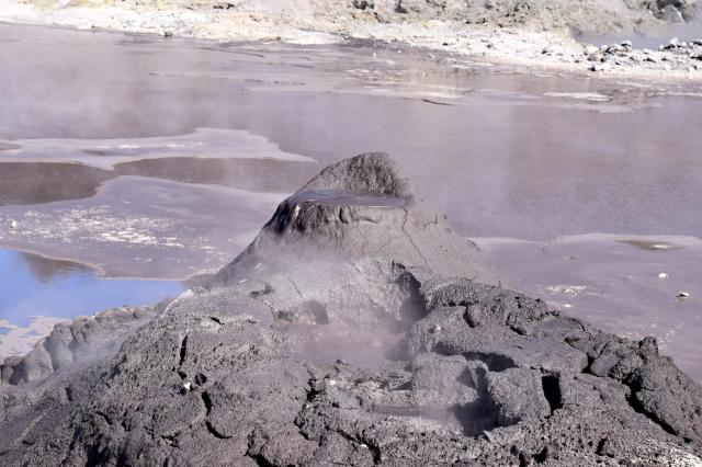
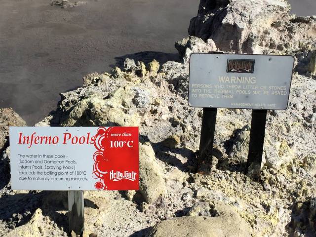
I made my way from Rotorua to Taupo the next day stopping at Hell’s Gate geothermal park. It was crazy how hot the mud/water was. The signs were a little interesting too…
Steaming mud volcano100 degrees celsius.. will make those that throw things in fetch said items.. hah.
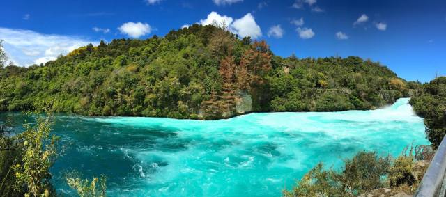
My airbnb in Taupo was right next to Huka Falls – which had some good hiking that I was able to do before checking into my airbnb. The actual falls were incredibly blue/teal. The photo doesn’t do the color of the water justice!
Huka Falls
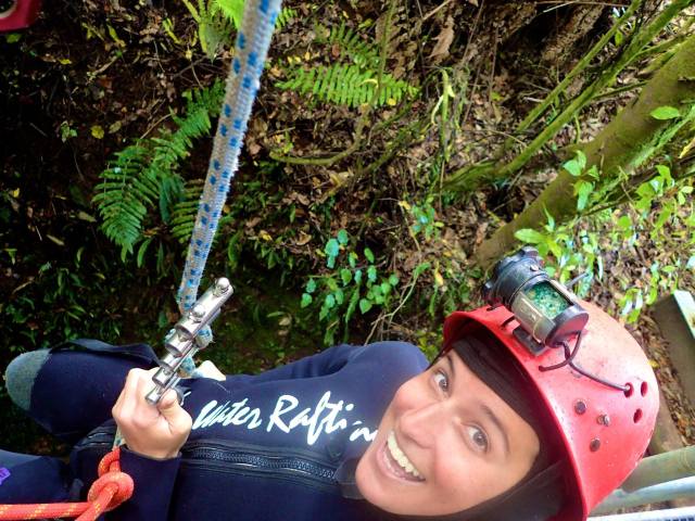
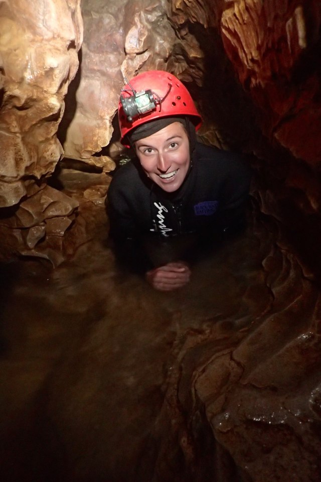
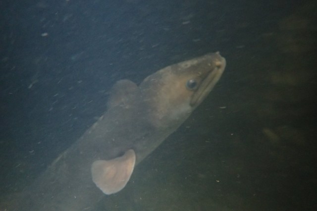
The next day I went out to Waitomo to do a caving excursion with the Black Water Rafting Company. This was super cool – abseiling down 35 meters, zip lining in the dark, rafting under the glow worms and rock climbing up waterfalls. Glow worms aren’t actually worms.. They’re maggots and the glow is them digesting. So technically we were watching maggots poop. On our way out, between climbing waterfalls, we encountered an eel that was probably close to 5′ long. The guide was able to coerce it out of our way so we could continue.
About to abseil down!In the caveOur eel friend
Emma, who lived at the Airbnb, joined me for a morning hike before I drove up to the Coromandel Peninsula. We wanted to go up Mt. Ngauruhoe (Mt. Doom for Lord of the Rings fans). It is also New Zealand’s most active volcano. We made it about 2 kilometers in before it started raining and continued on for another 3 before we were completely drenched and decided it best to turn around. The visibility was crap and it just wasn’t worth it. I was bummed but we would have been miserable if we had continued on. It would have been impossible to go all the way up anyways because of the ice. Unfortunately I didn’t get any photos of the mountain.
My final day was spent in Thames on the edge of the Coromandel Peninsula. It was just a quick overnight before heading to the airport. The flights back to Maine were long – ended up being around 28 hours of travel after a delay from Philadelphia to Portland, but I made it back on Sunday. Over the next few weeks I’m going to figure out what my next plans are…stay tuned!
I mentioned in a previous post that I’ve had a bad cold for all of my trip so far – and I still do. Either from coughing so hard or bungy (or both), I’m pretty sure I’ve cracked a rib or two. It hurts to breath. It REALLY hurts to cough (unfortunately I’m doing that a lot). And a sneeze means a long chain of shouted expletives will immediately follow. I like to think I have a fairly high threshold for pain, but the constant cough on the ribs is torture. I think I’ve spent more on cold medicine and pain reliever on this trip than I’ve spent on food!!
Chris and I wrapped up exploring the South Island with a trip to Mt. Cook. It was incredible. It was a short walk out to the base of the mountain where a small glacial beach was – ice bergs and all! We were lucky enough that it was sunny – and were tempted to go for a swim!
Standing in front of Mt. CookAnother of Mt. Cook
Around the corner from Mt. Cook was the Tasman Glacier. The Tasman Glacier is New Zealand’s longest glacier, and has been shrinking pretty significantly over recent years. You can see along the edges where the glacier used to come up to.
Tasman Glacier
Yesterday, Chris headed back to the states and I flew to the North Island to do a little more exploring. This morning I found a really nice little hike up to Wairere Falls on my way to Hobbiton! The falls were stunning, and the hike up was just as nice – it was like walking through a rainforest. Even nicer was the fact that it was completely peaceful – I didn’t see anyone else on the trail.
One of the smaller waterfalls on the way upWairere Falls
After the hike I made my way to The Hobbiton Movie Set to geek out a little. I just watched the Lord of the Rings trilogy for the first time a few months ago – and I have to say the set was really cool. It was your typical New Zealand weather throughout the tour – sometimes sunny and warm, other times dreary and raining!
Looking out at the ShireHobbit HouseAnother hobbit houseThe famous Bag End
At the end of the tour they gave you a beer at the Green Dragon – and warming up by the fireplace with a beer was just what was needed! The dark ale that I had was one that you can only get there – you can’t buy it elsewhere!
After Hobbiton I drove to my AirBnB in Rotorua. I’m getting really comfortable driving on the opposite side of the road! I have to say…the views from my airBnB are one of a kind. Tomorrow I’ll explore Rotorua and then head to Taupo for a few days!
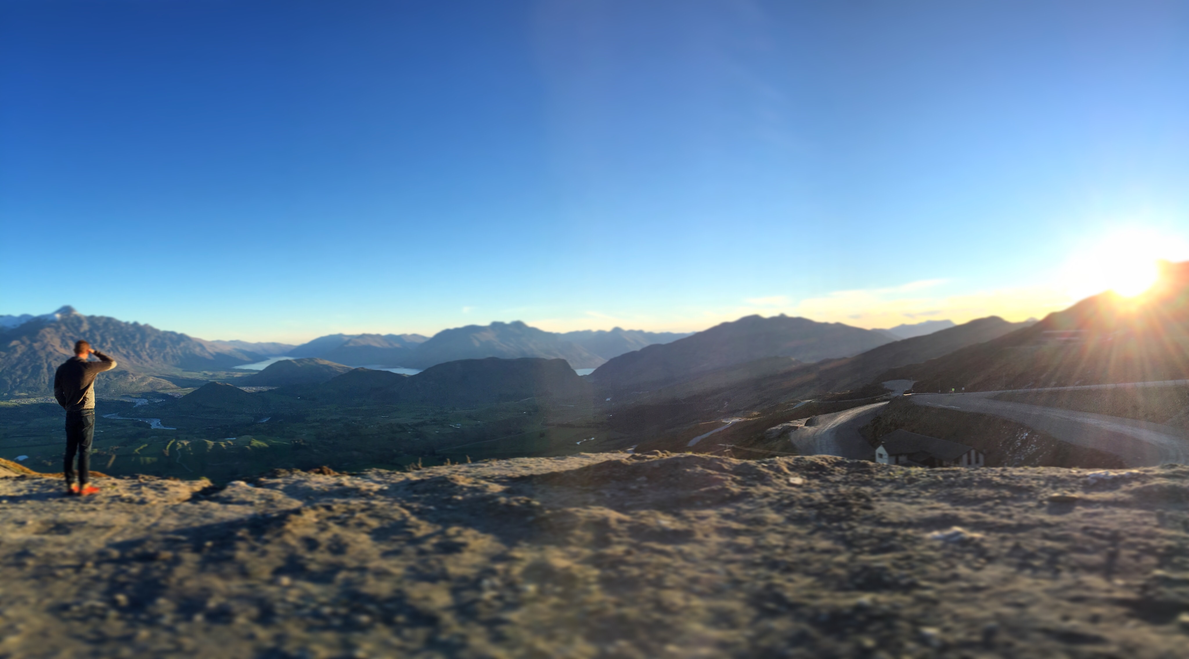
A week in New Zealand and we’re just getting started! Our Airbnb is perfect – we have a small place close to Queenstown but outside of the hustle and bustle of tourists. It’s spring here, so still a little chilly but we’ve still managed to pack a lot in! The easiest way to share is to just break it down by day, so here it goes.
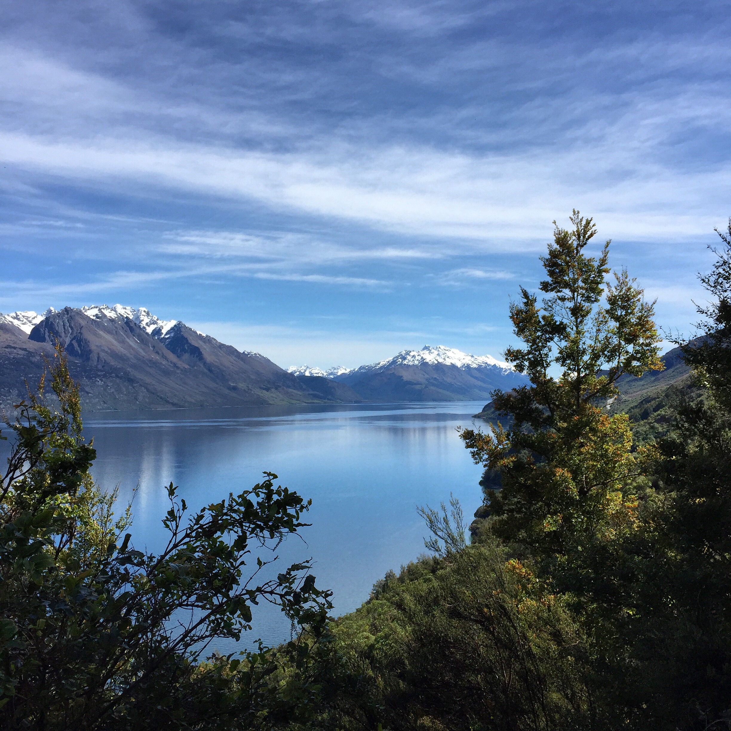
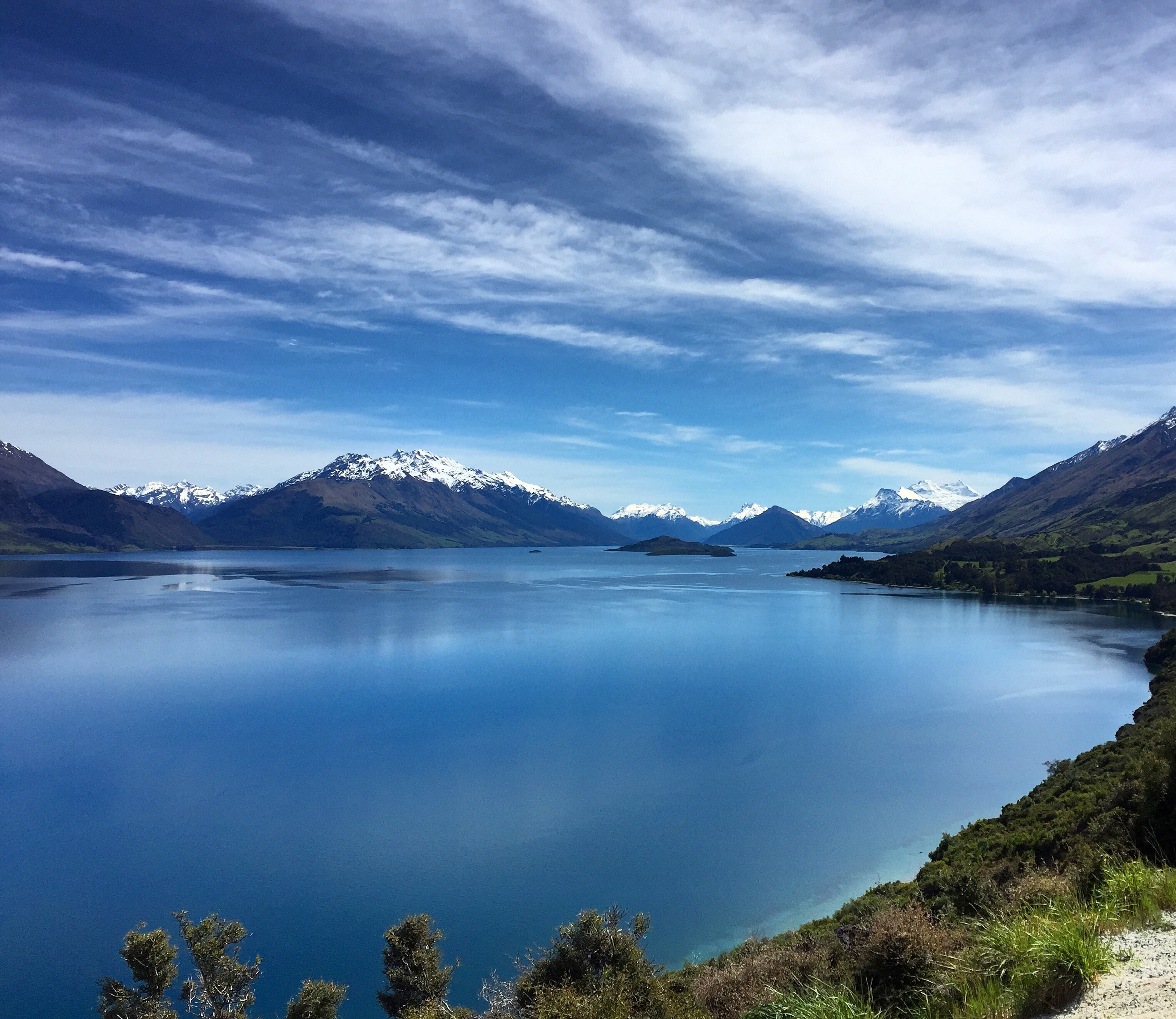
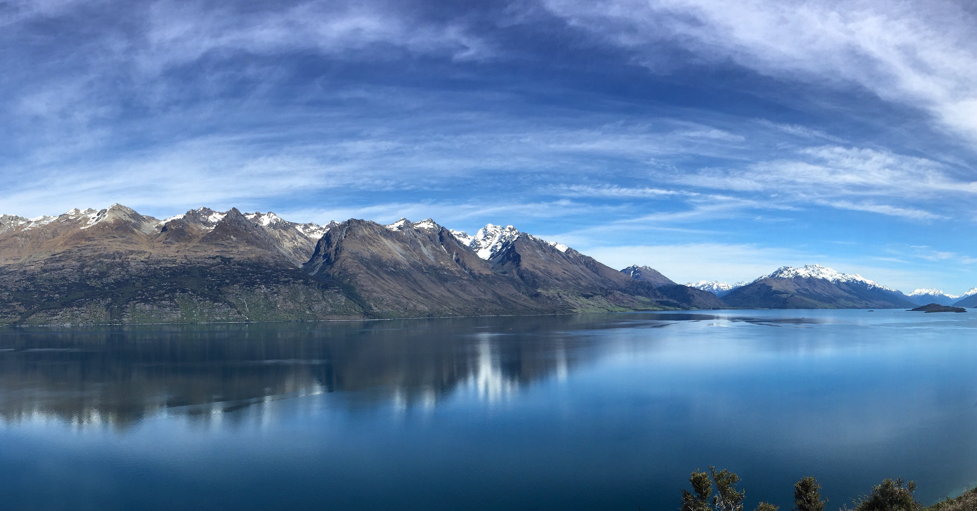
Arrival evening: Sunset at the base of Coronet Peak Ski AreaDay 1: We drove out to Glenorchy down the Glenorchy Road, and around every corner was another stunning viewpoint of Lake Wakatipu. The town of Glenorchy itself was small, and we took the rental car down some dirt roads searching for Lord of the Rings filming areas, but unfortunately our tiny car wasn’t able to pass a flooded road.Glenorchy RoadGlenorchy RoadGlenorchy Road
We went to catch the sunset at one of the viewpoints looking over Queenstown. I was excited to see a little piece of home with a Sugarloaf sticker!
Sugarloaf in New Zealand!
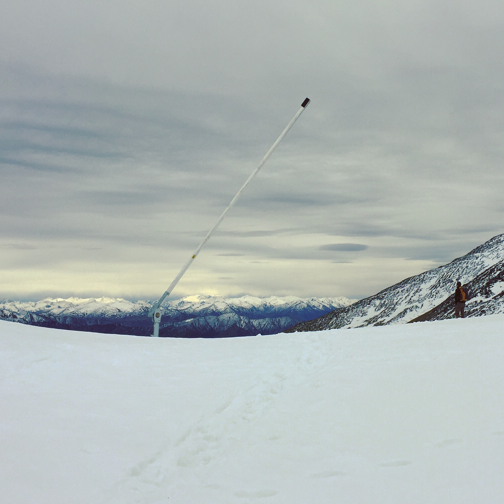
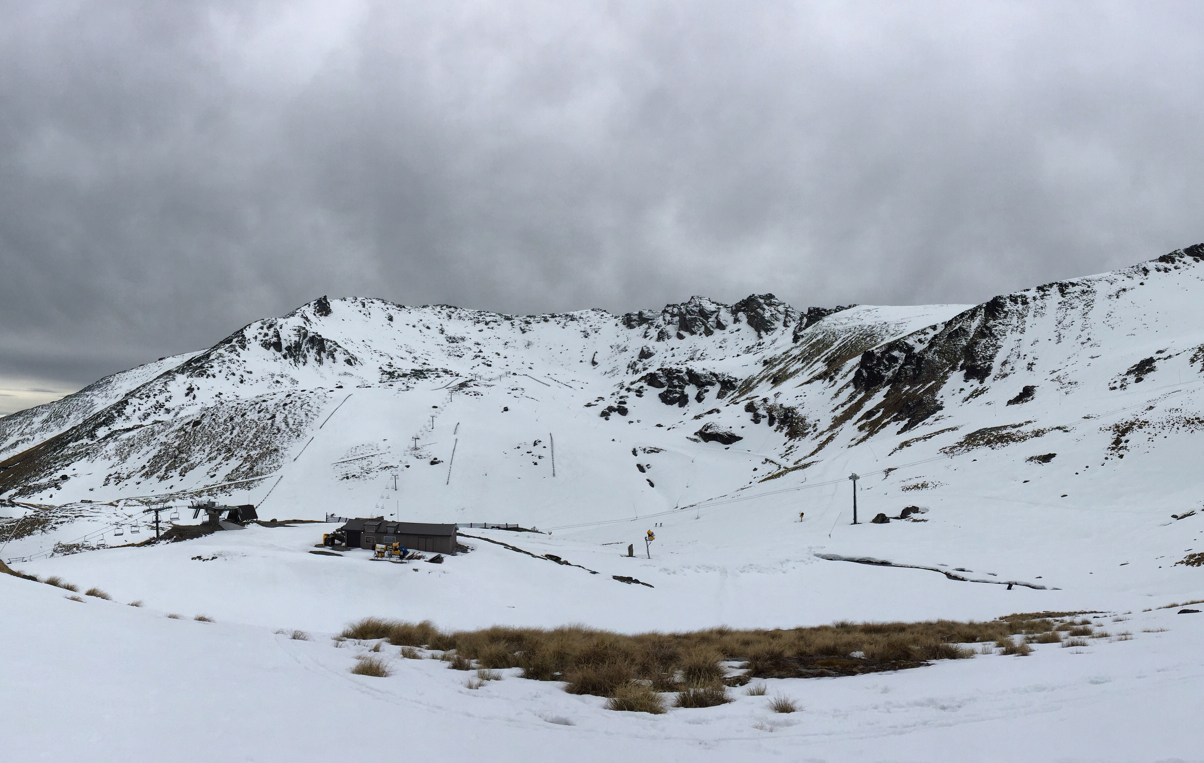
Day 2: We did a short hike up to Lake Alta at The Remarkables Ski Area. Stunning views, but you couldn’t see the lake because everything was still snow covered!
View from the RemarkablesThe Remarkables Ski Area
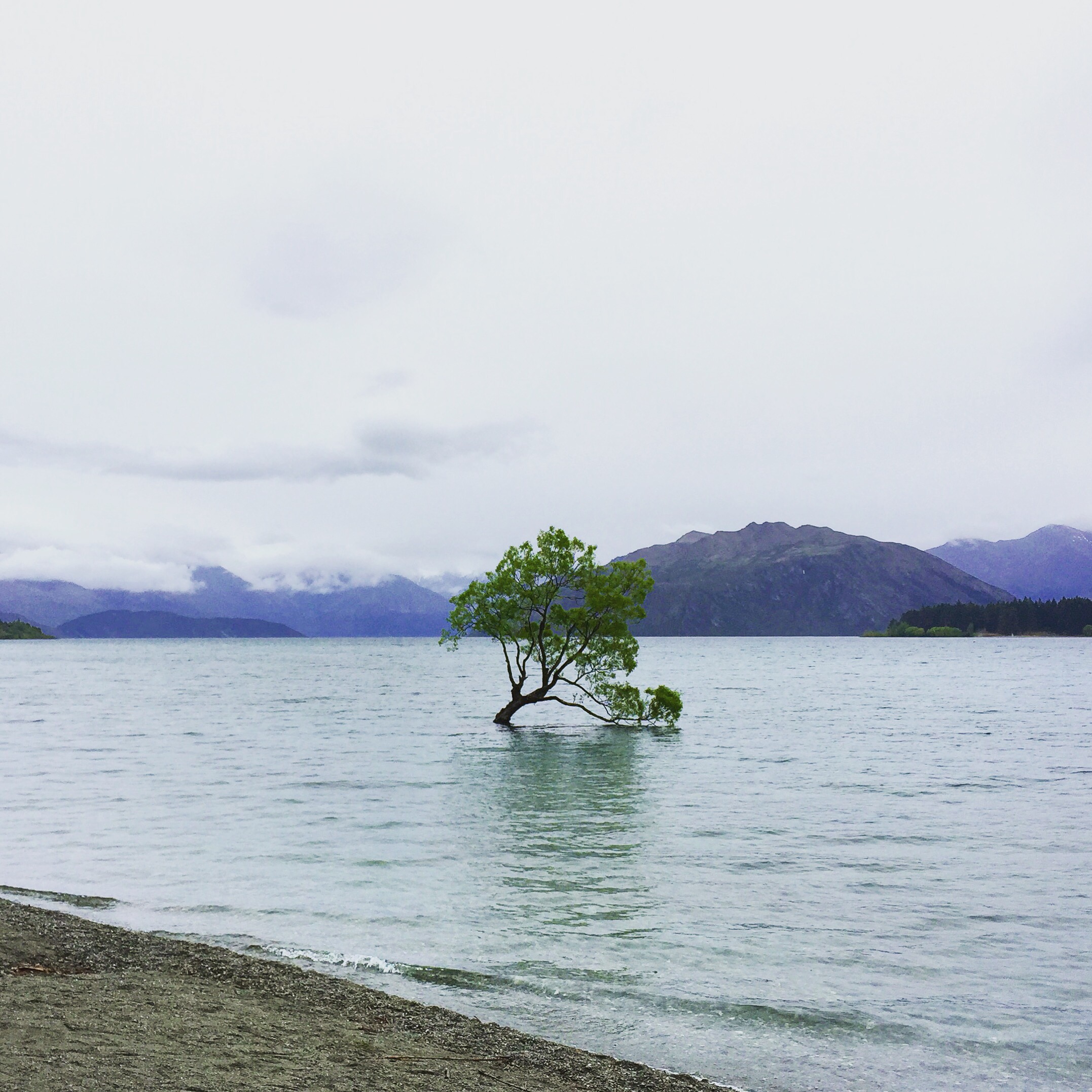
Day 3: We headed out to Lake Wanaka where the famous Wanaka tree is. We did a short hike and made it back to the lake for sunset (even though it was too cloudy to see the sun).
Hiking in WanakaThe famous Wanaka Tree
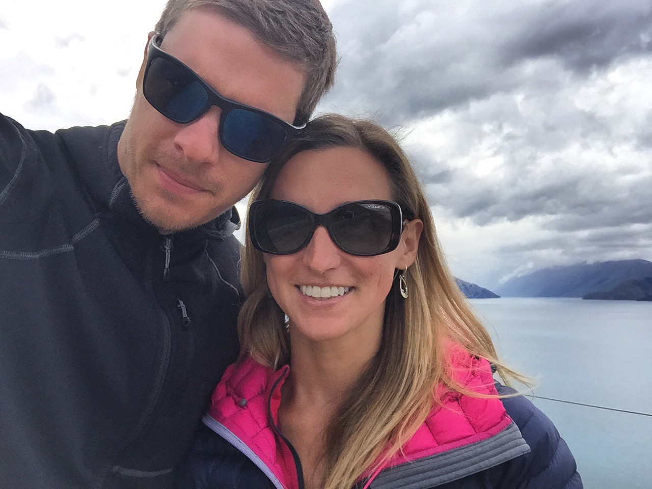
Chris and me at a viewpoint stop near Wanaka
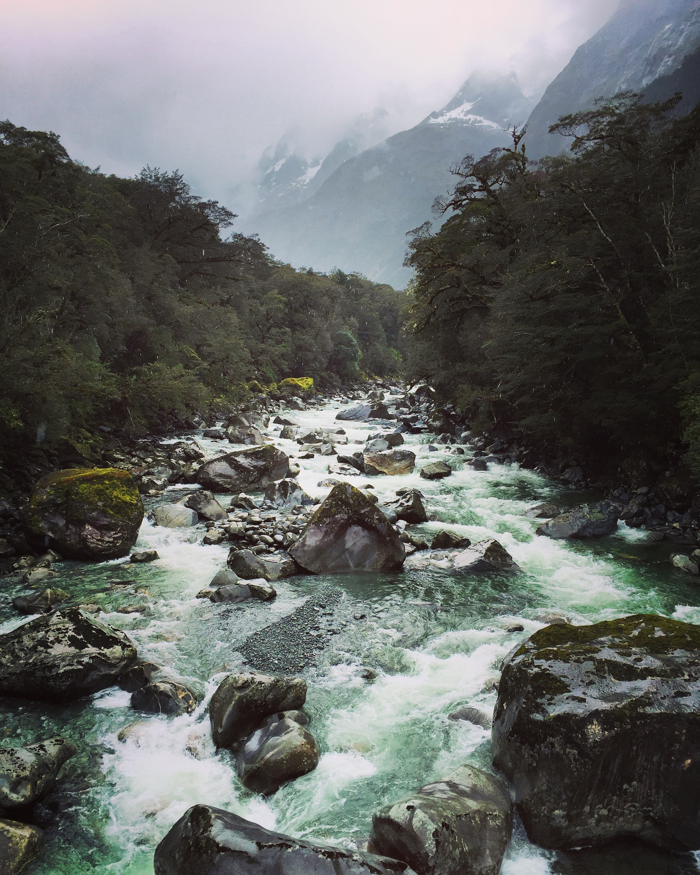
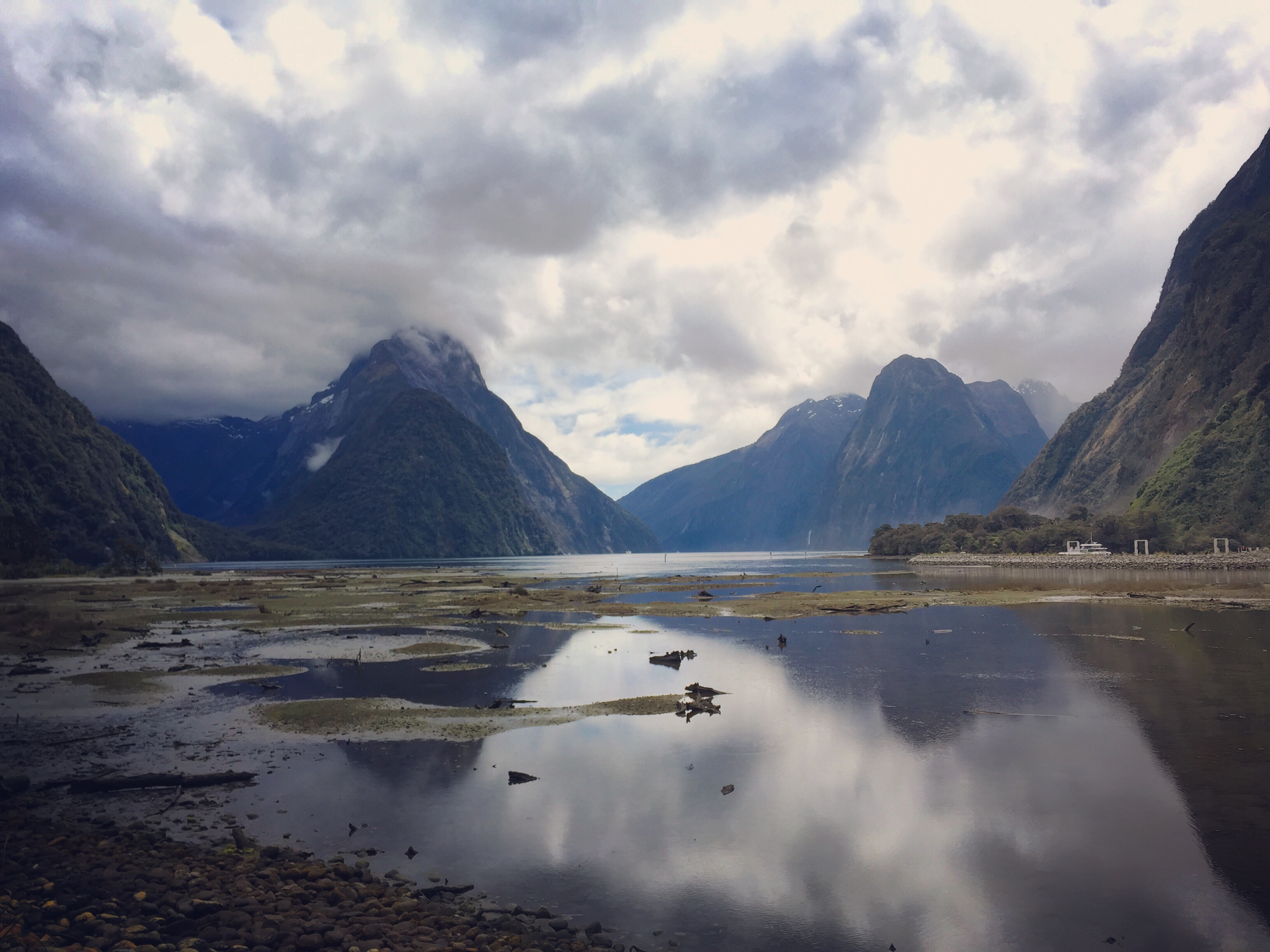
Day 4: We decided to drive to Milford Sound – which is a whole day trip. Part of what we heard was so amazing about Milford Sound was the drive – so we did 4 hours there and 4 hours back. It was stunning.
Waterfall on the road to MilfordMilford Sound
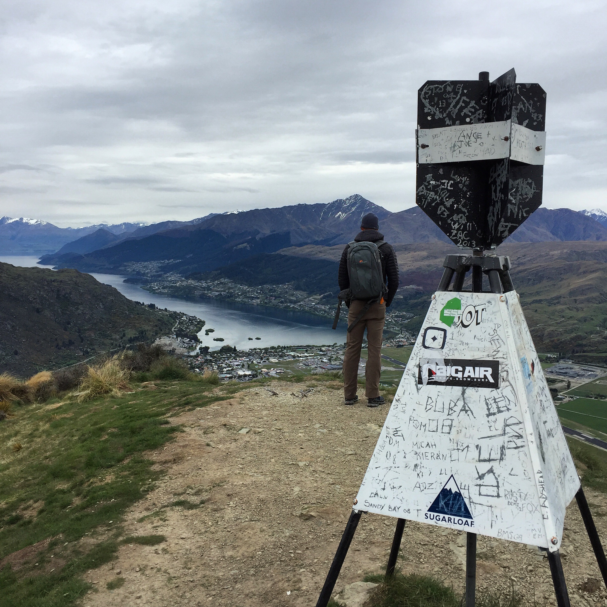
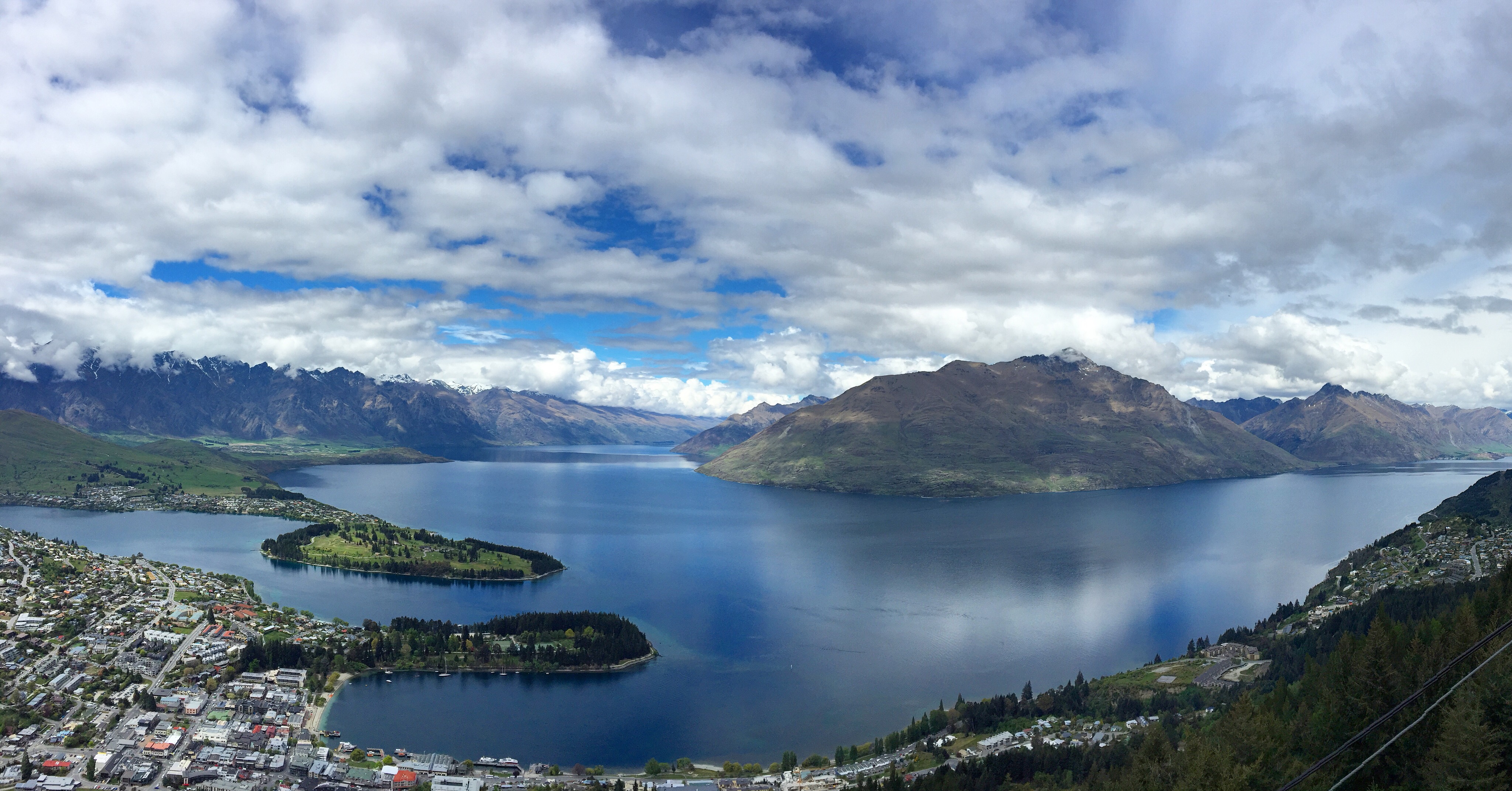
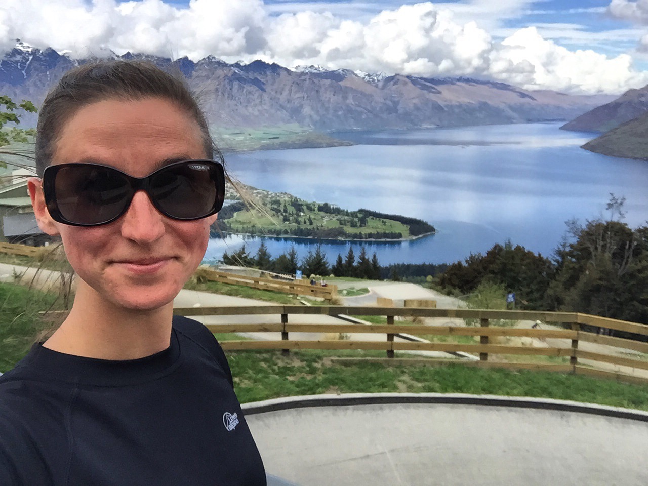
Day 5: The Skyline in Queenstown is a gondola that takes you up part of a mountain in town for some amazing views. I did a small part of the Ben Lomond hike while Chris killed the whole thing (I’m not in shape to do that sort of hike, on top of the cold that I’ve had for the last month).
View from the SkylineHad to take a selfie
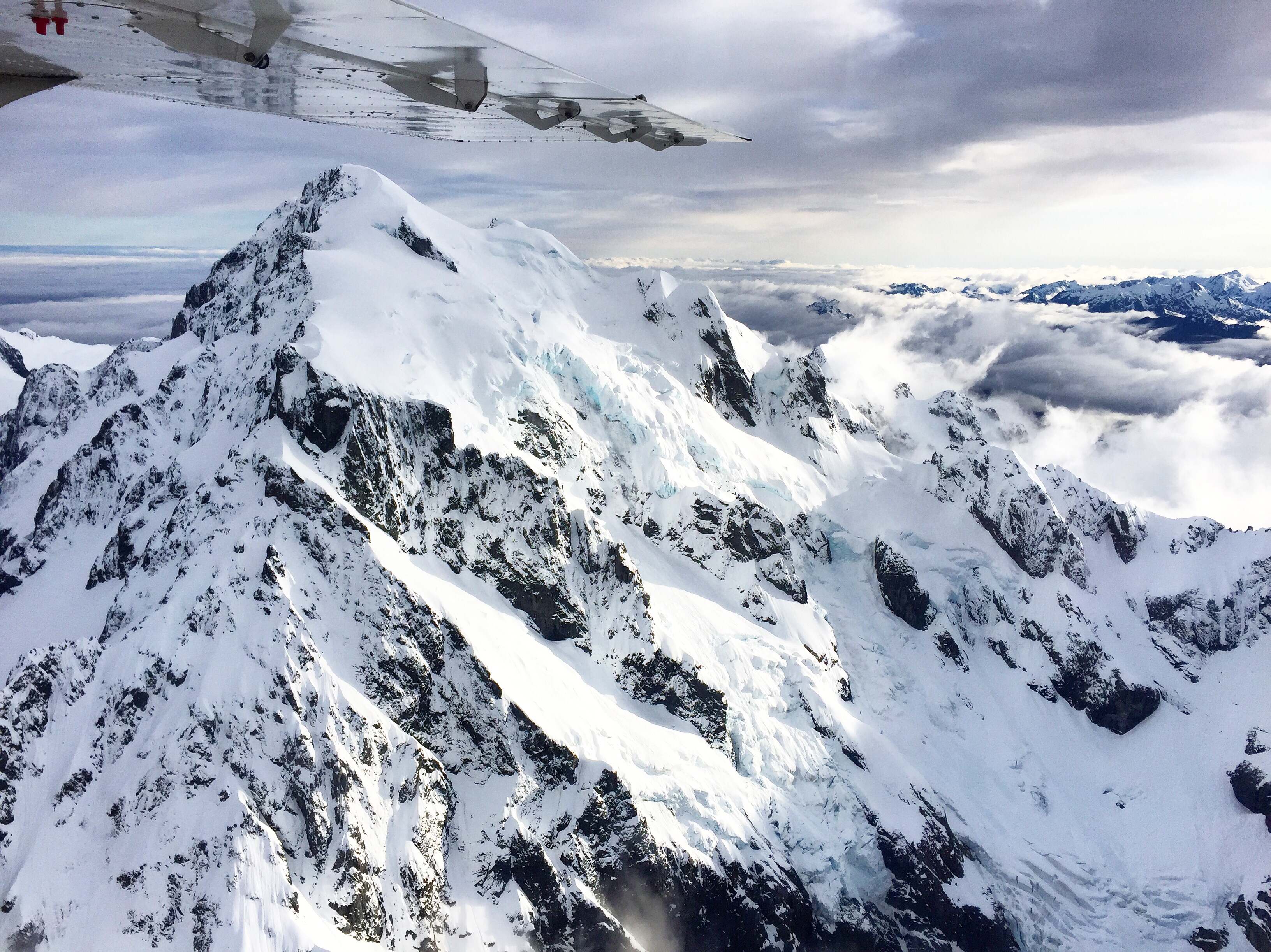
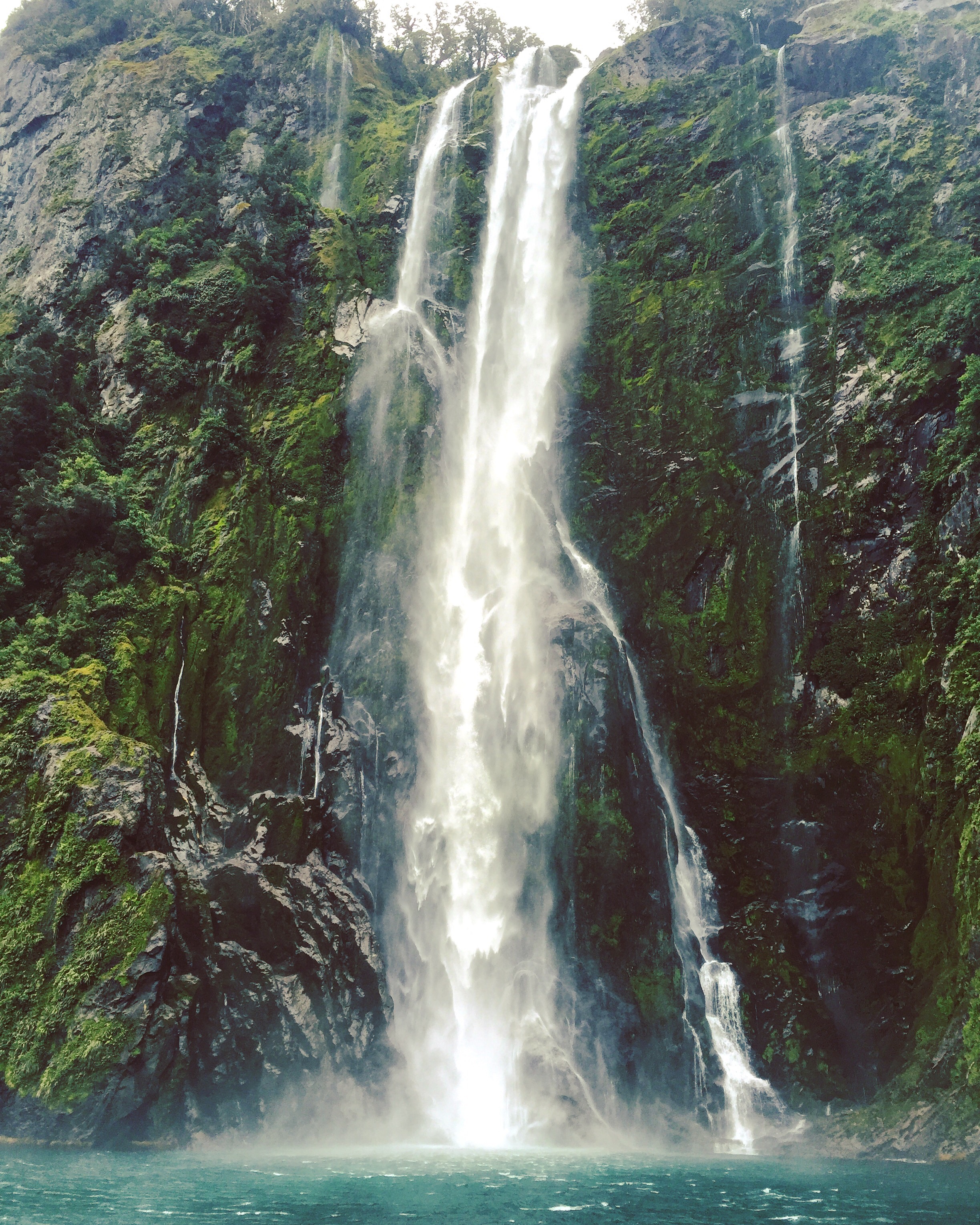
Day 6: The morning was spent back at Milford Sound – but this time we flew with Glenorchy Air over the Southern Alps. The views of the Alps and the Sound by air were breathtaking. As part of the trip we also took a cruise around Milford Sound to get up close to the sights and waterfalls.
Southern AlpsMore AlpsSterling Waterfall
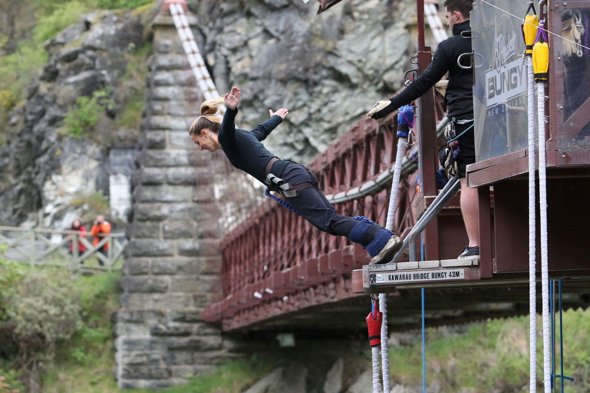
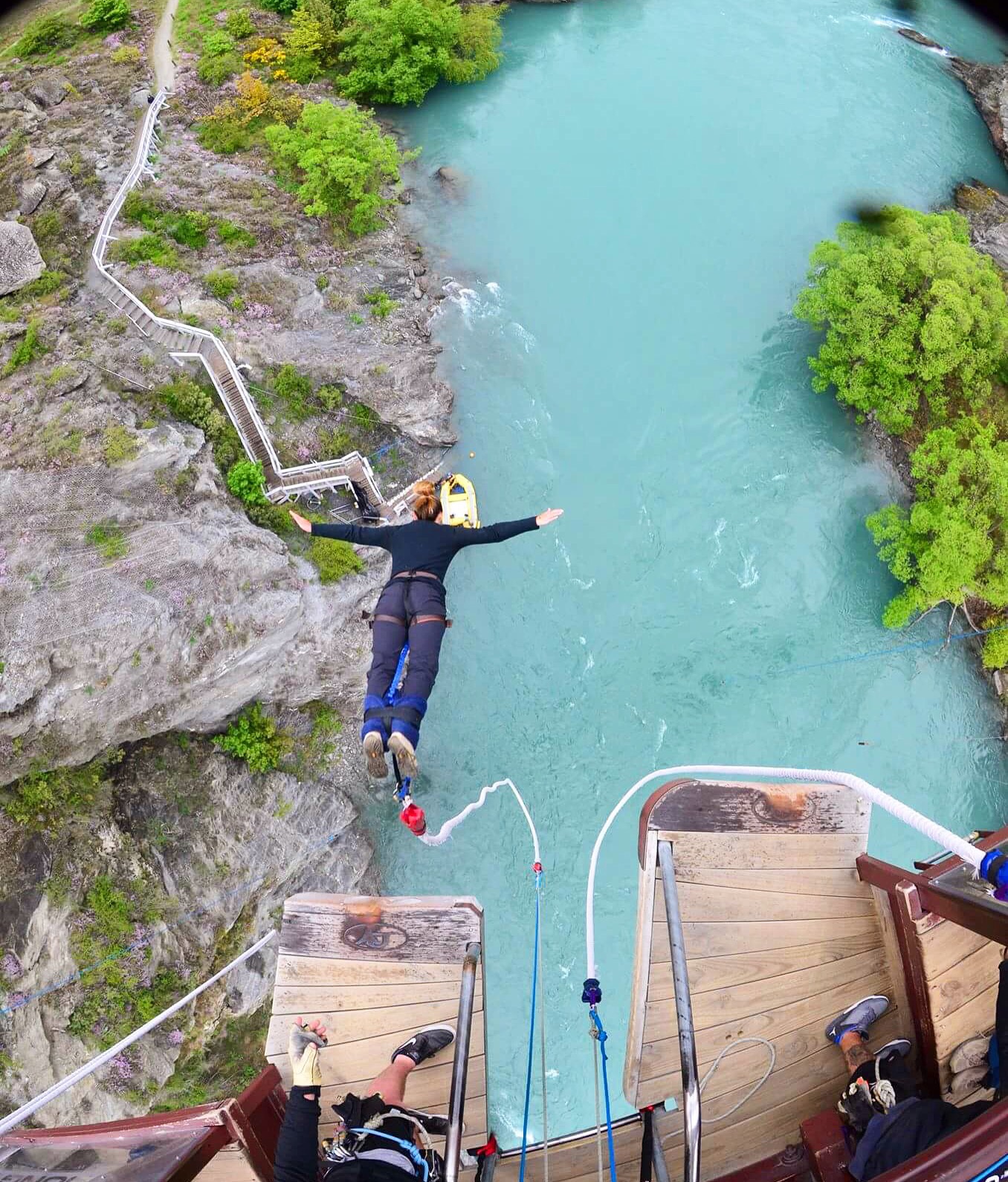
I decided to have my “when in Rome” moment and bungy jump off the Kawarau Gorge Suspension Bridge. This is the worlds first commercial bungy jumping site. When My feet were getting tied up, the guys told me I probably wouldn’t be able to touch the water unless I put on a few pounds (they confirmed my weight 3 times before I jumped). I said bummer, and they looked at each other and said “ok, we can try some things.” They made a few adjustments and told me what to do with my hands and head to ensure I touched water. I would most likely get my hands wet, but there was also a chance of my head going under, depending on how well I followed directions. Not only did my head go in, my entire upper body went in. It was amazing. I definitely recommend it! Everyone else who went around the time I did screamed. Apparently I was completely silent. It was almost relaxing, but a total adrenaline rush at the same time.
New Zealand is turning out to be amazing. I don’t want to leave!
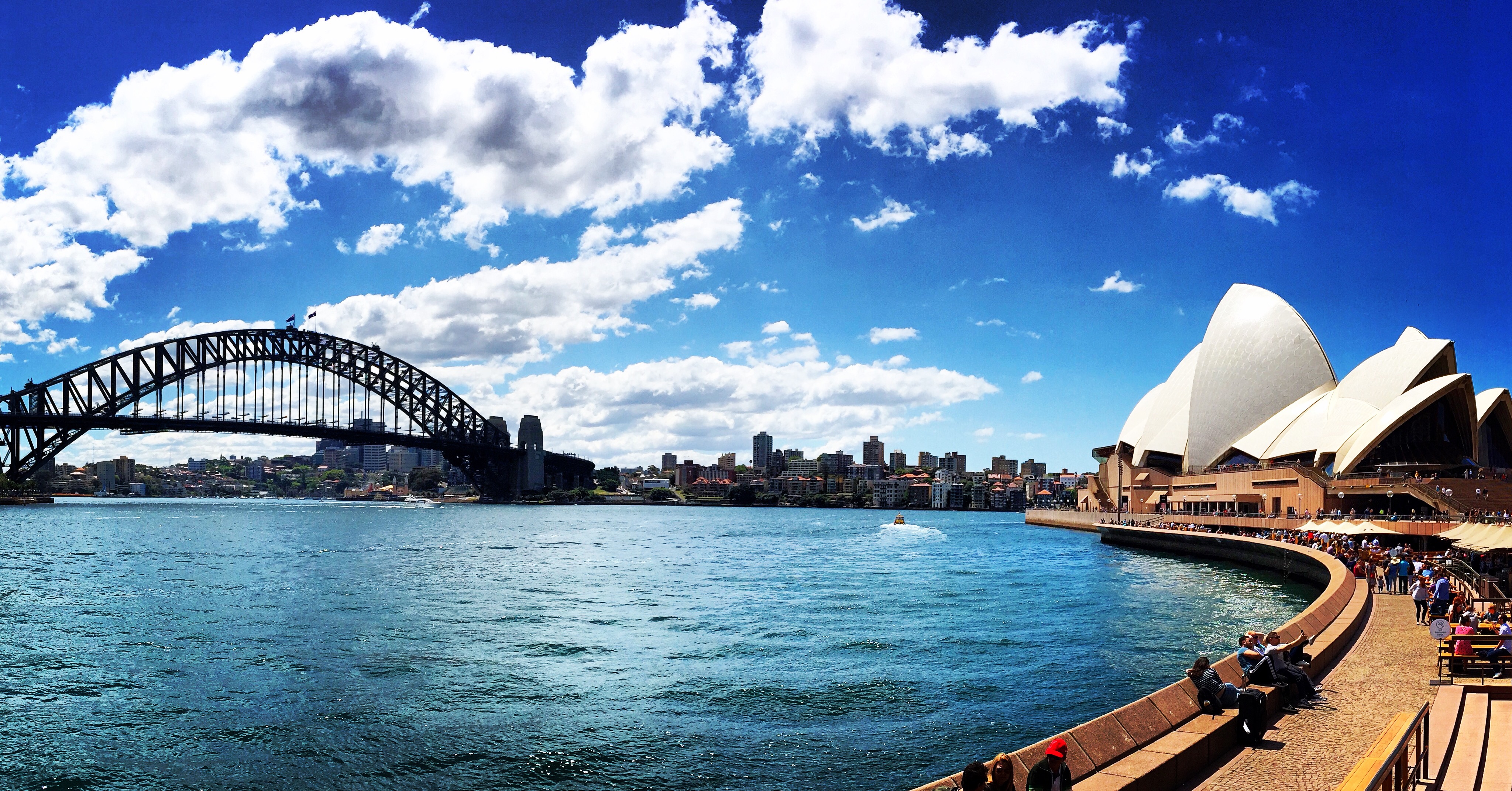
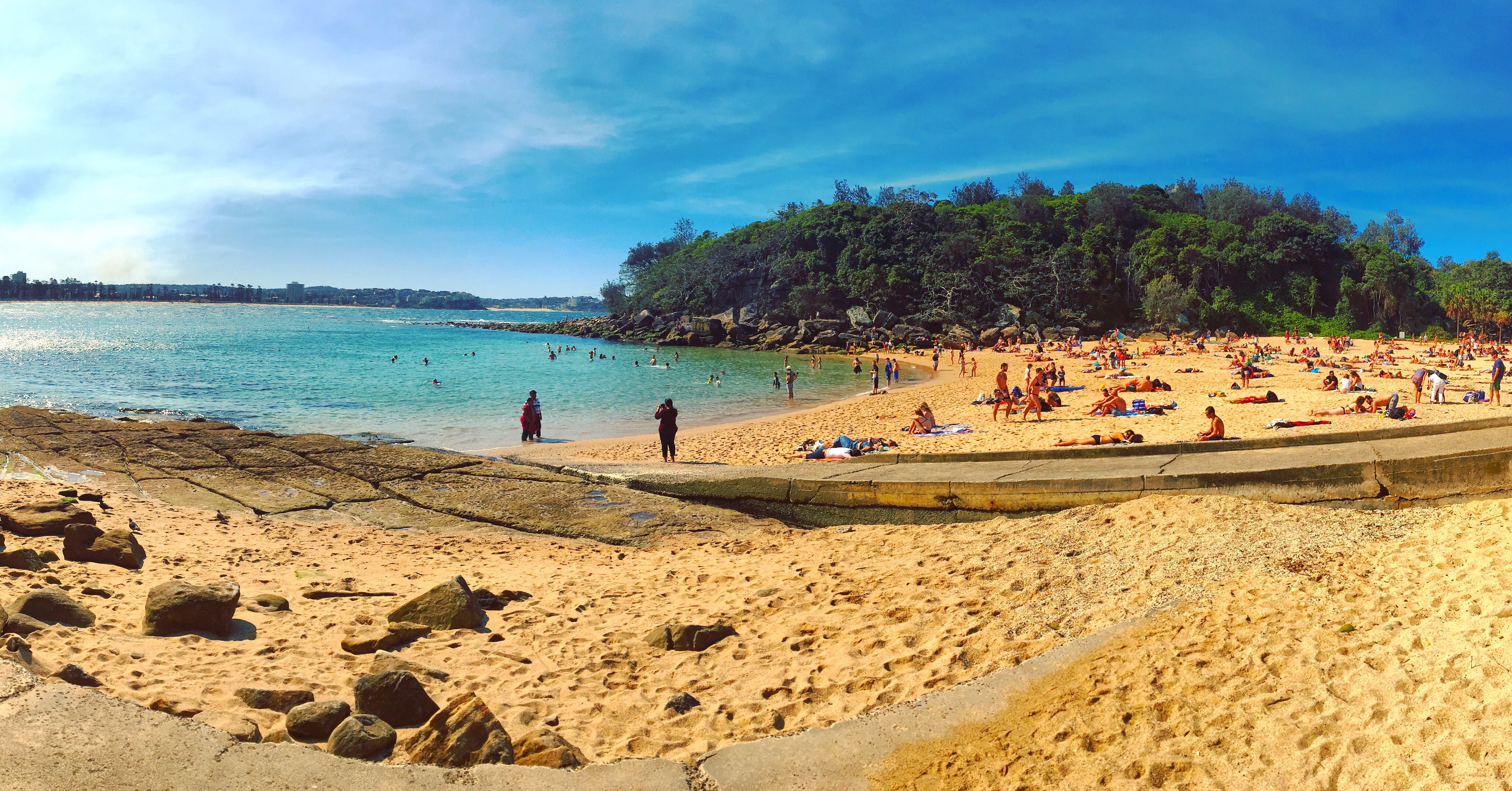
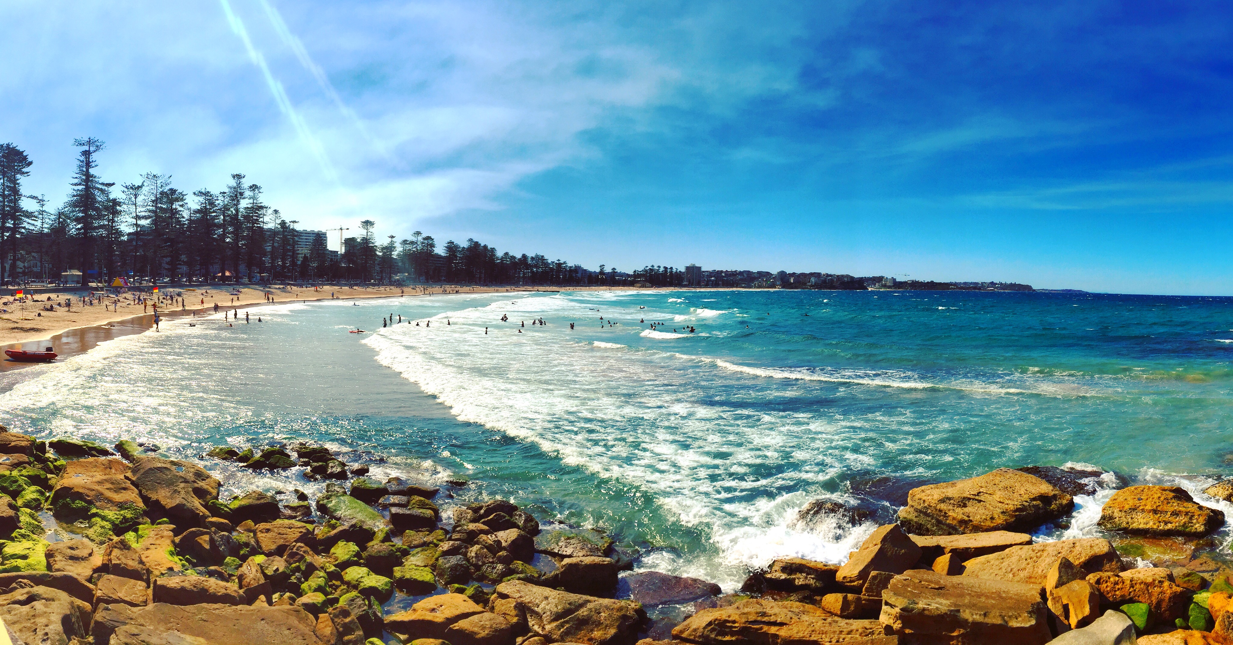
I arrived at my first hostel in Sydney – at the Rocks. The Rocks is essentially the Portland Old Port of Sydney. The rooftop had an amazing view of the Opera House and the Harbour Bridge. I spent the next couple days exploring the area and taking in the beer and food festivals going on! I also managed to catch the ferry out to Manly and explore North Head National Park and hike around to Manly Beach. The trail was not well marked, and sometimes not marked at all so it was a fair amount of backtracking and guessing – but I made it! I passed Shelly Beach – which was essentially a party beach. Everyone was using the BBQs and the beach was packed!
View from my hostel!Little cove on my walk around North HeadView from North HeadShelley Beach!Manly Beach
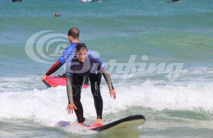
I spent Monday – Friday at Bondi Beach – at the Bondi Beach House hostel. This was surf central. I signed up for 3 surf lessons – I recommend spacing them out with a few days in between. The first two days were amazing. I was already on the shorter board making turns and taking on green waves. By day 3 I couldn’t move my arms. I had to call it quits a little before the lesson ended because it really wasn’t safe for me to be out. I was physically exhausted and because of that and the extreme surf, I had already taken a surfboard to the head, inhaled about 3 gallons of water and fell so hard on the sand bar I’m pretty sure I had an instant bruise on my ass.
Hate the watermark.. But first day and already up!
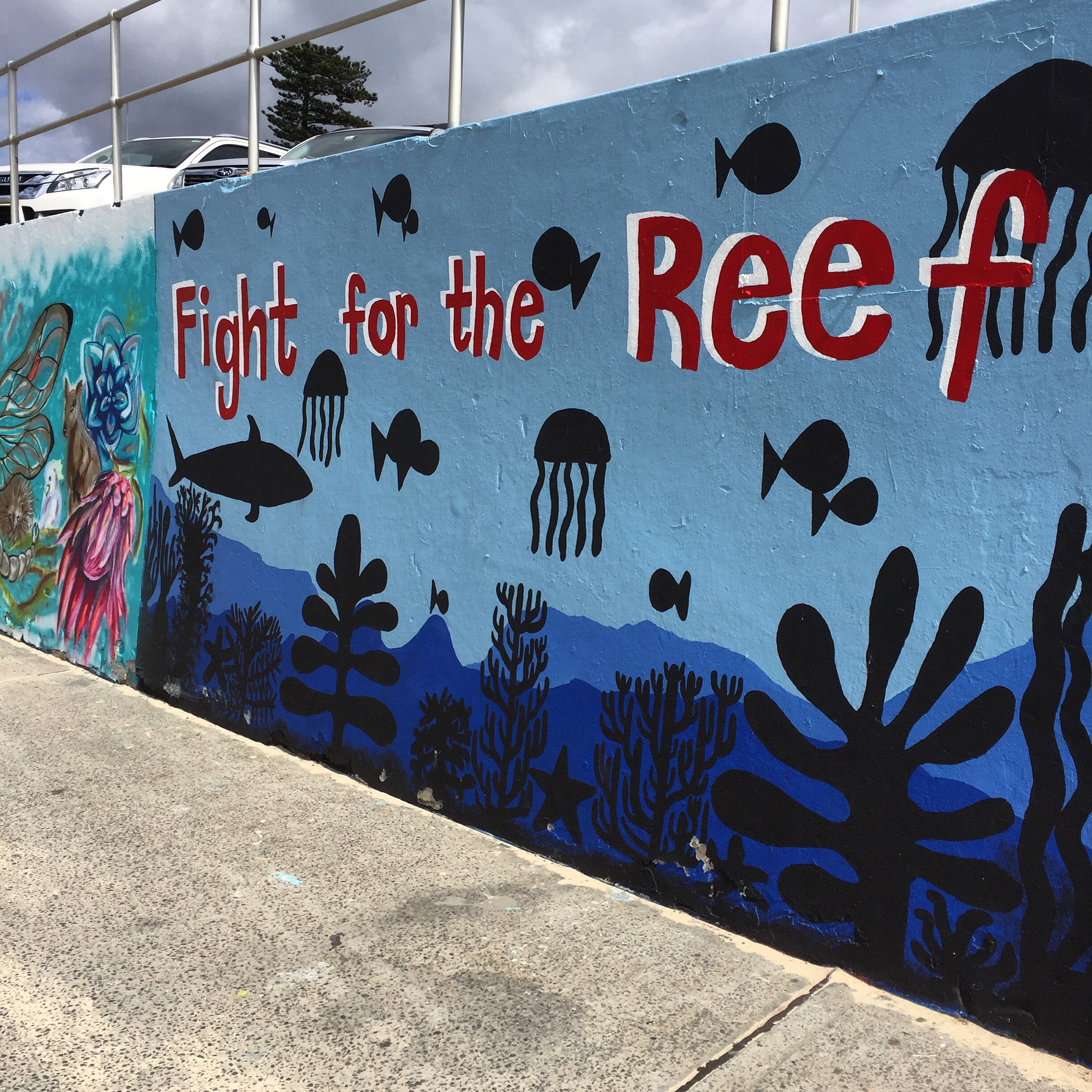
My hostels in Sydney and Bondi were 4 people and 6 people. For the most part it was good. I’ve met some really interesting people from different places. Everyone asks about the current political climate, as they are extremely concerned about what will happen and what he worldwide implications will be if a certain individual lacking political experience becomes president of the US. That has been a hotter topic than the death of the Great Barrier Reef.
Just made it to New Zealand and am thankfully staying at and AirBnB in Queenstown for the next couple weeks. Chris, a friend from Portland and was actually able to join for a couple weeks so I’ll have some company exploring the South Island of New Zealand!
View from 5 minutes away from where we’re staying in NZ
I was told I needed to incorporate some Aussie slang into this post.. So there are a couple terms included below!
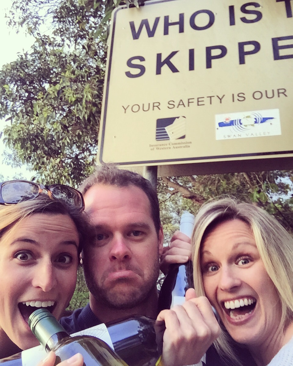
I left Melbourne and made my way to Perth (Western Australia) to visit my friend Roland and his girlfriend Lauren. Roland spent a year at UMaine in the same MBA program I was in back in 2010. They picked me up at the airport and we almost immediately headed out to Swan Valley to the wineries. Lamont’s was by far our favorite because Scott was running the show. As he mixed himself a Bloody Mary, he introduced himself as a bitter old man – and to check the trip advisor reviews if we didn’t believe him. He was hilarious! Sarcasm at its finest.
Roland was the skipper (DD)
The next day we explored Fremantle – or as the locals call it, Freo. We did a tour of the Fremantle Prison which was interesting – it closed in 1991 and had pretty brutal facilities up until then. If women weren’t working, they were essentially left outside in a cage in the blistering hot sun with no shade. They also didn’t have any hot water for bathing. It was almost as if it was from the early 1900s instead of 1991!
We went out for dinner/drinks to a super cool brewery called Little Creatures right on the water where I tried kangaroo! I also learned that because there is no ozone layer over Australia, sun burns are common. They had massive containers of sunscreen hanging from the trees on the patio.
Trying Kangaroo! It was good!
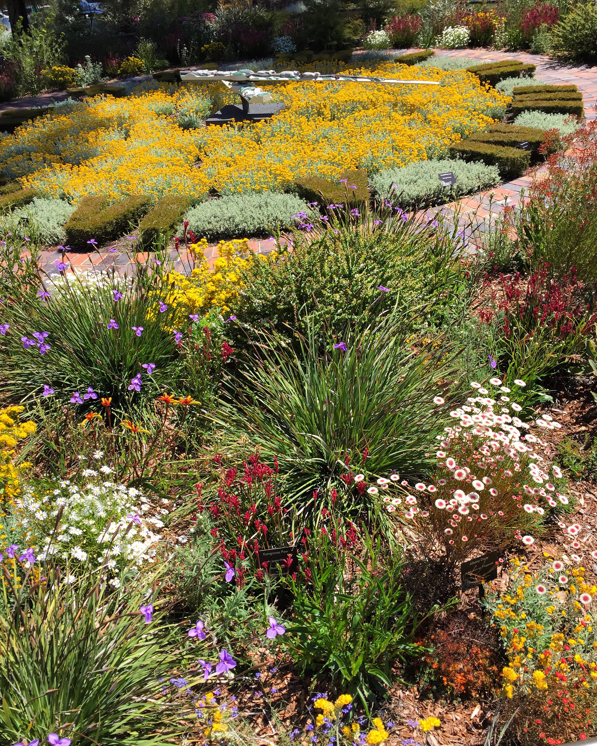
The following day, after strolling through Kings Park, we headed a little south to Serpentine National Park. We spent the afternoon doing a 13km hike up to the second falls. We wrapped up the day visiting the Serpentine Dam and watching the sunset from a viewing point. It’s wildflower season here so the wild flowers and sheer number of South African water lilies was incredible!
Wild flowers in Kings ParkSerpentine FallsSouth African Water LilyPit stop during the hikeSunset at Serpentine National Park
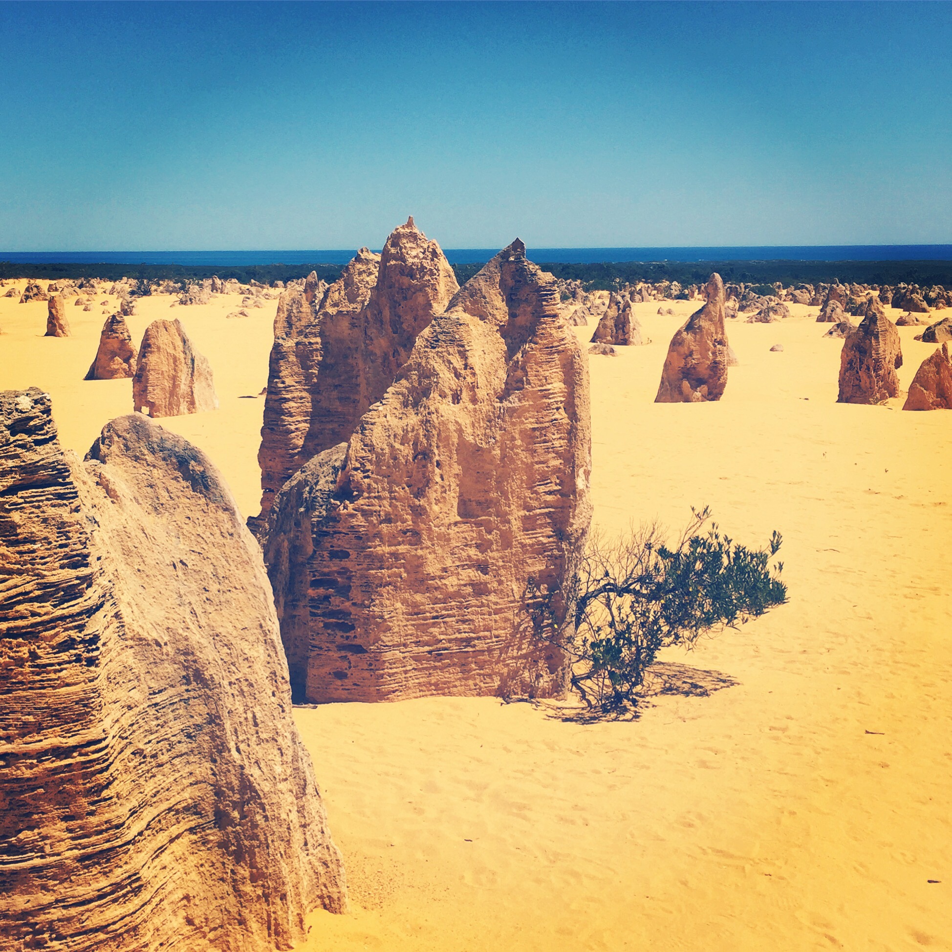
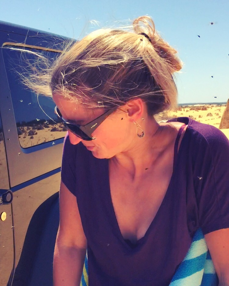
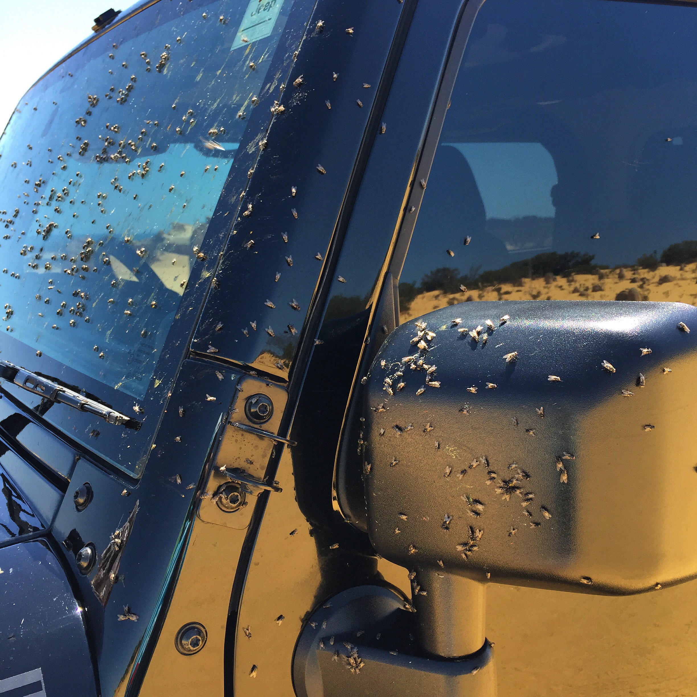
Yesterday we took a drive a few hours north to go the the Pinnacles Desert National Park and a remote beach. The Pinnacles are these rock formations that were formed around 500,000 years ago. There were so many it looked like a little city! It was also the day the flies hatched.. Which made it almost unbearable. I felt like a livestock animal that couldn’t get away from them.
The PinnaclesThe flies were unbearableFlies covering the Jeep
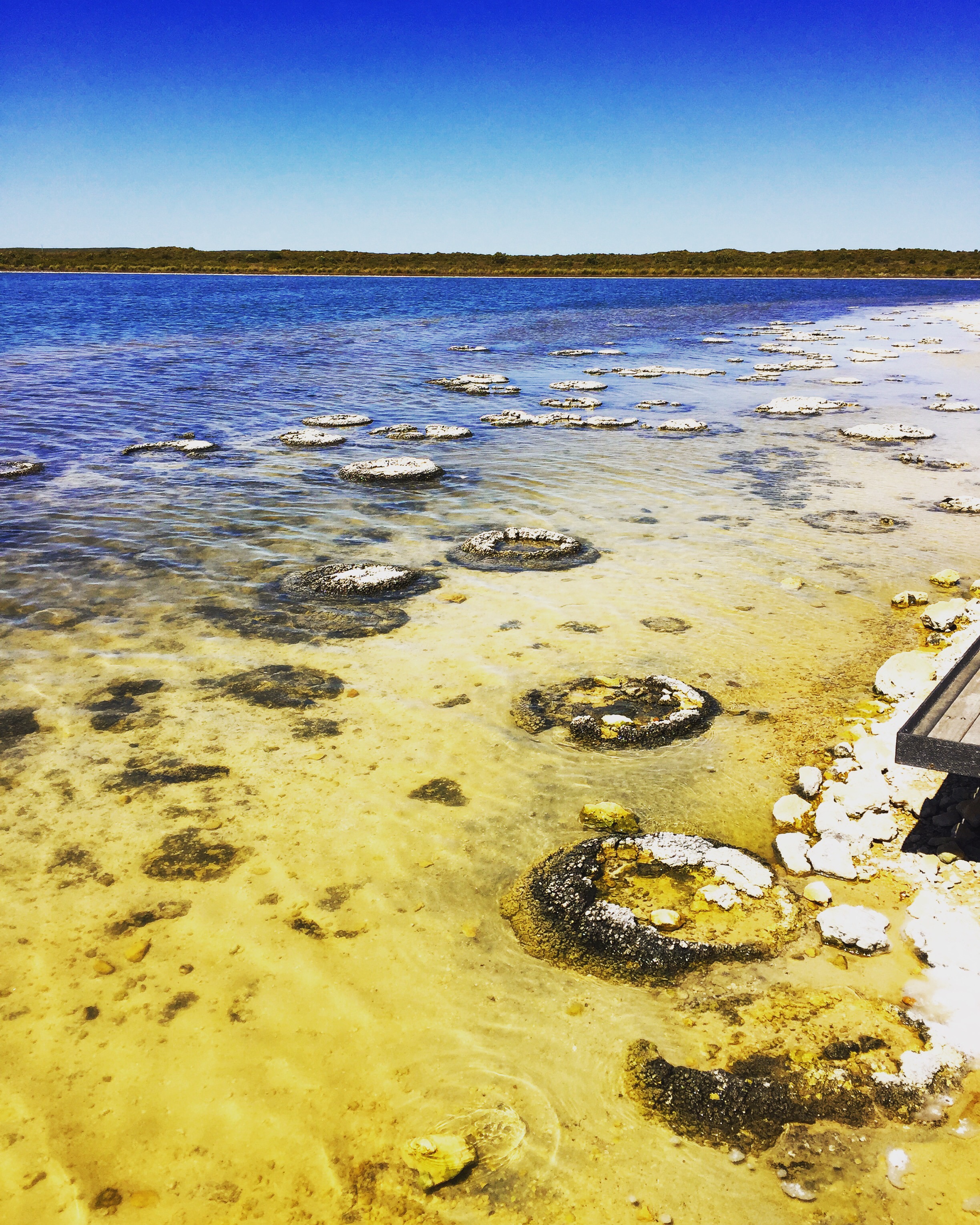
Nearby we stopped for a squiz (a quick look) at Lake Thetis (more like a pond) to see the stromatolites. Stromatolites are similar to one of the earliest living organisms in the world that provided oxygen. A little further north in Western Australia, the Pilbara is home to stromatolite fossils that are 3.4 billion years old.
The circular forms are stromatolites
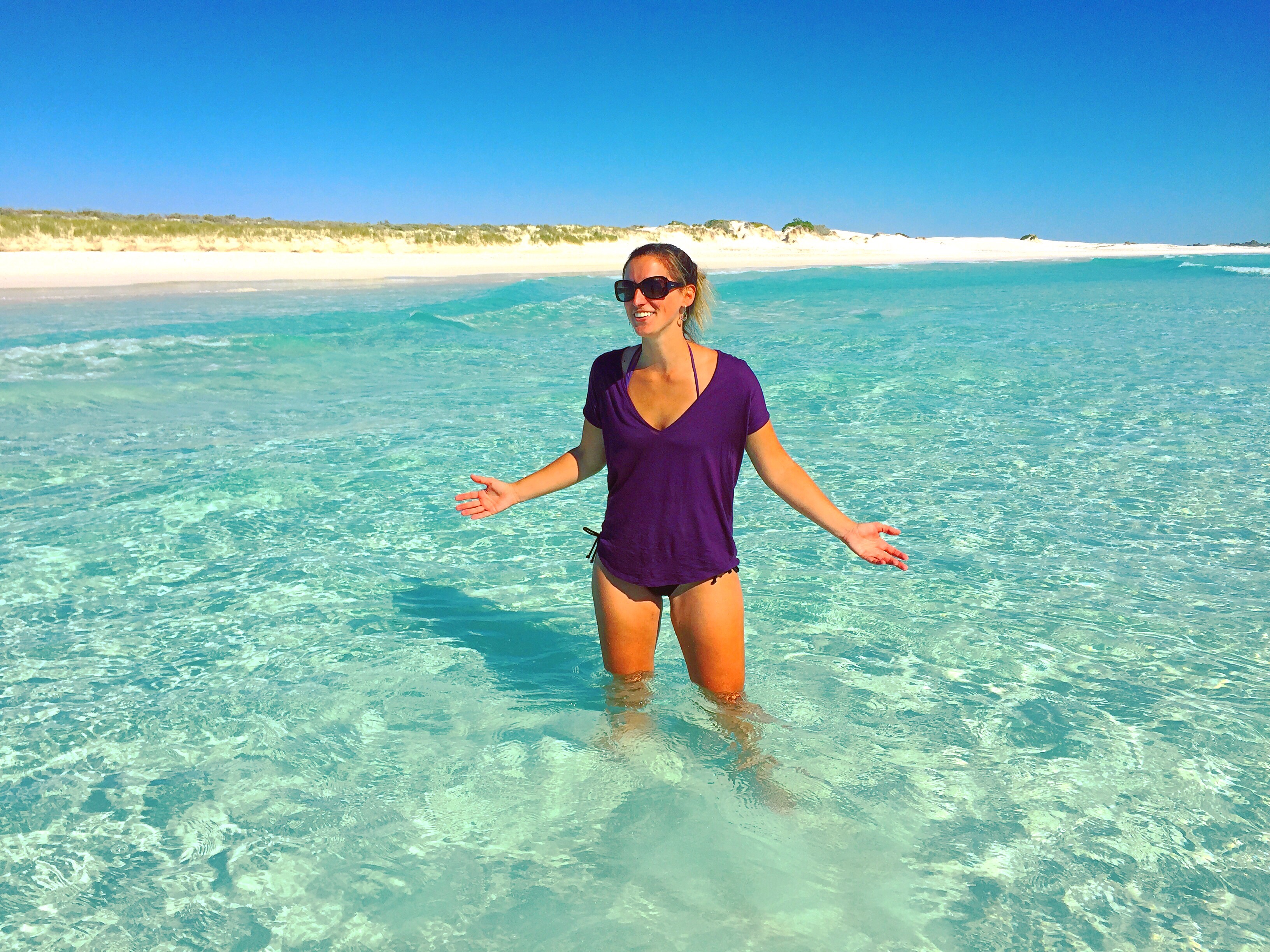
After the Pinnacles we took the Jeep to Wedge Island. You need a 4×4 to get out there – because it’s essentially off-road, sand dune and beach driving. It was stunning and tropical. The water was crystal clear. We were one of only a handful of trucks on a 3 mile stretch. It amazed me how perfect the beach was in every way and to have virtually no one there. The water was warm enough and the sun was hot, so we enjoyed some relaxation and wine for a while before heading back. Unlike the beaches in Europe, no budgie smugglers (banana hammocks) were seen!
We had the beach to ourselves!
I just arrived in Sydney and will be here for about a week before heading to New Zealand!
After pretty much fully recovering from jet lag, I met up with a guy who took me to St. Kilda’s beach to check out the little penguins. They make their homes right off the boardwalk there. It was amazing…cute little guys just walking around the boardwalk or hopping around the rocks. You couldn’t use flash because it would blind them, but you can see we were able to get pretty close!Little Penguins on the boardwalk
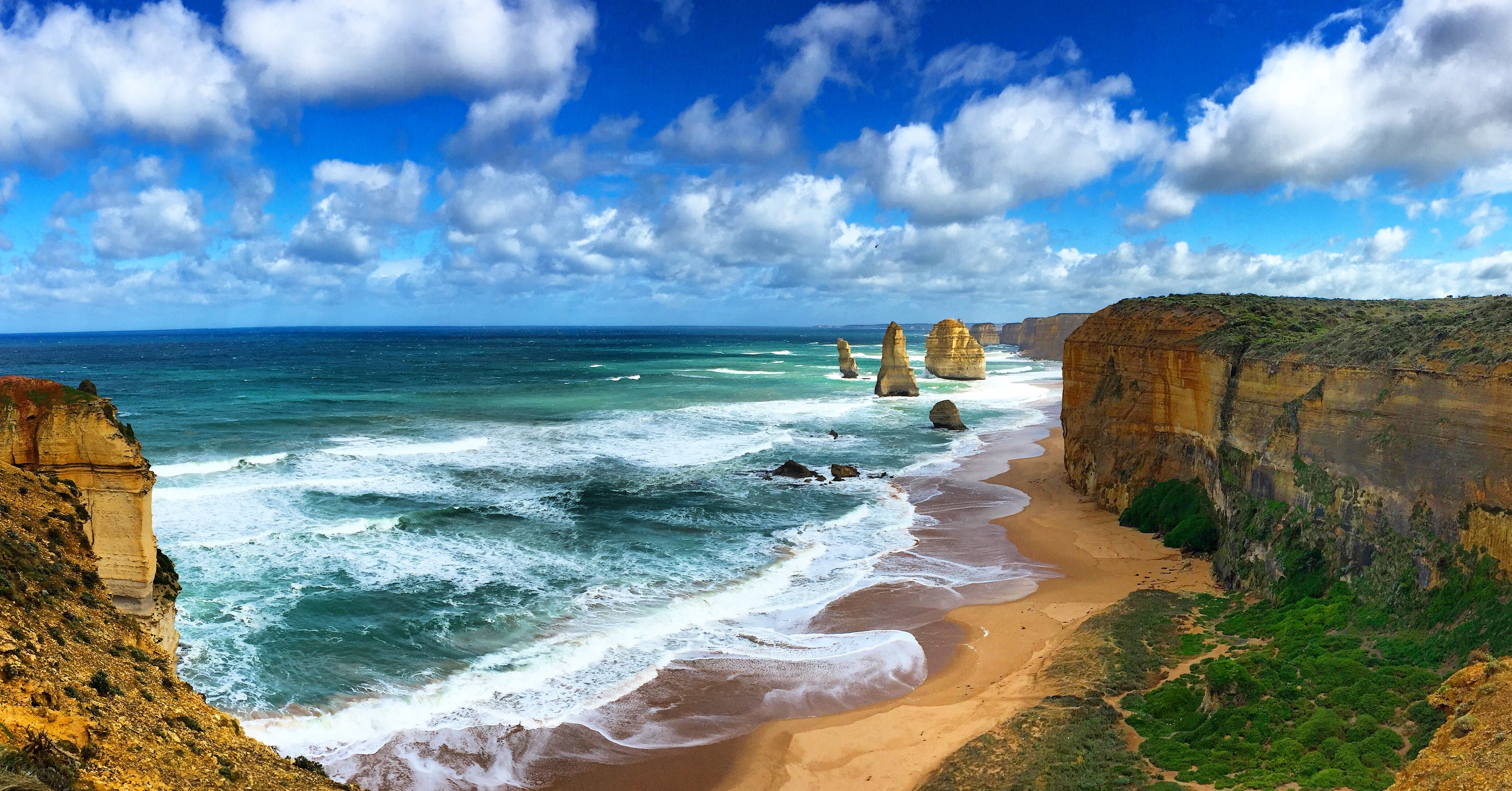
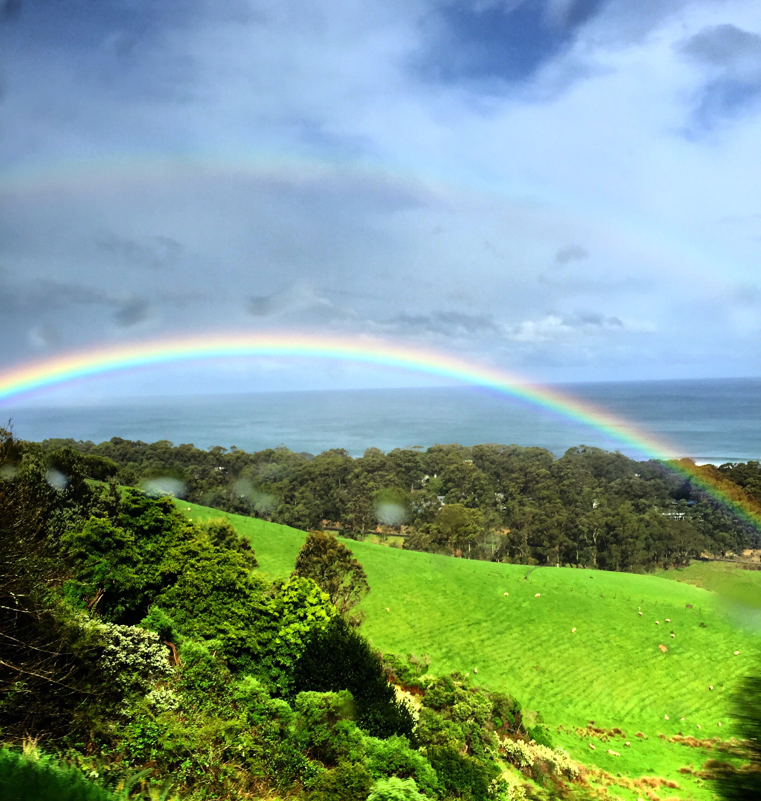
I spent the following day on the great ocean road. It’s about a 3 hour drive to Melbourne, but it is worth it. The views are absolutely stunning. The 12 apostles was one of the major sites, and actually started as just 10 rock formations but are now 8 because of deterioration. It’s all sandstone and limestone so as the waves and wind crash against them they weaken. If you do anything in southern Australia, I would say definitely do the Great Ocean Road.
Loch Ard Gorge on the Great Ocean Road12 Apostles (though there are only 8)The beach off Gibsons Steps on the Great Ocean RoadCape Otway Light – it was blowing about 70 mph at the top!Double Rainbow as we were leaving the Great Ocean Road
Another day was spent visiting an animal sanctuary and then we went to Phillips Island to the Nobbies and to see more Penguins.
Koala!Wallaby and his friendThe Nobbies
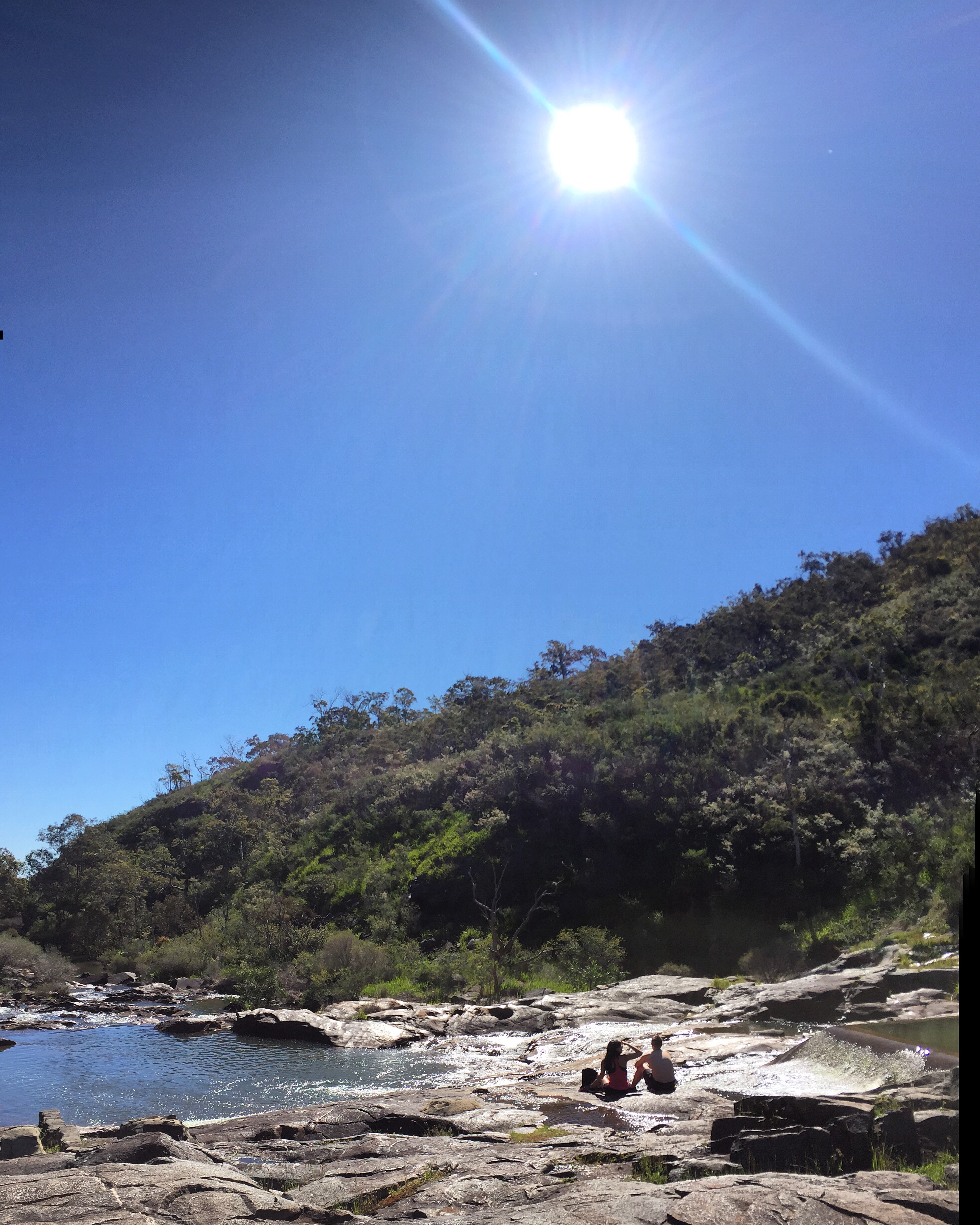
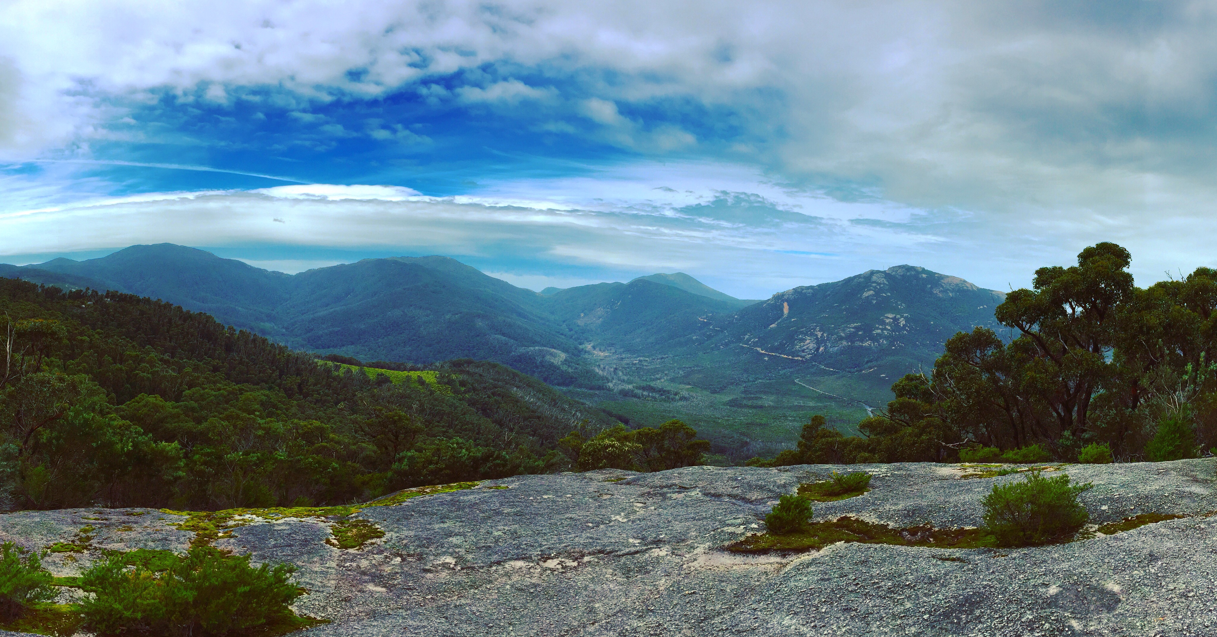
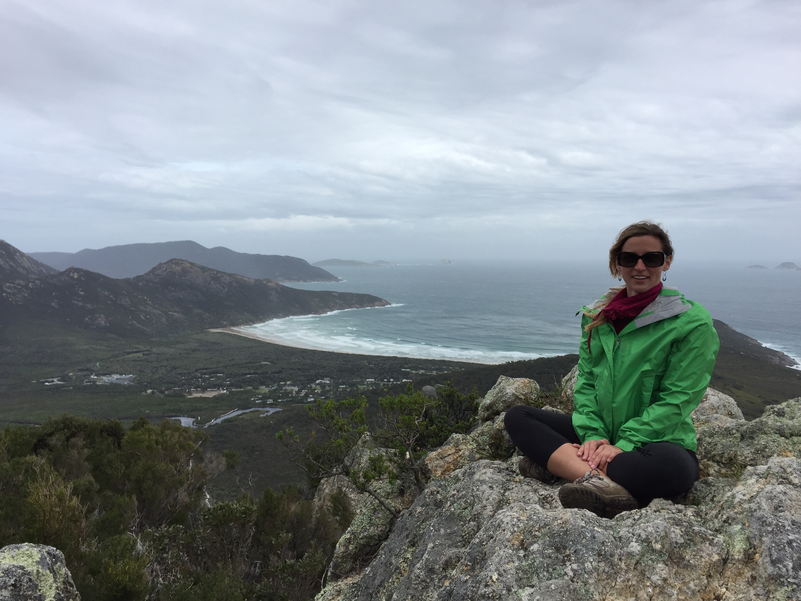
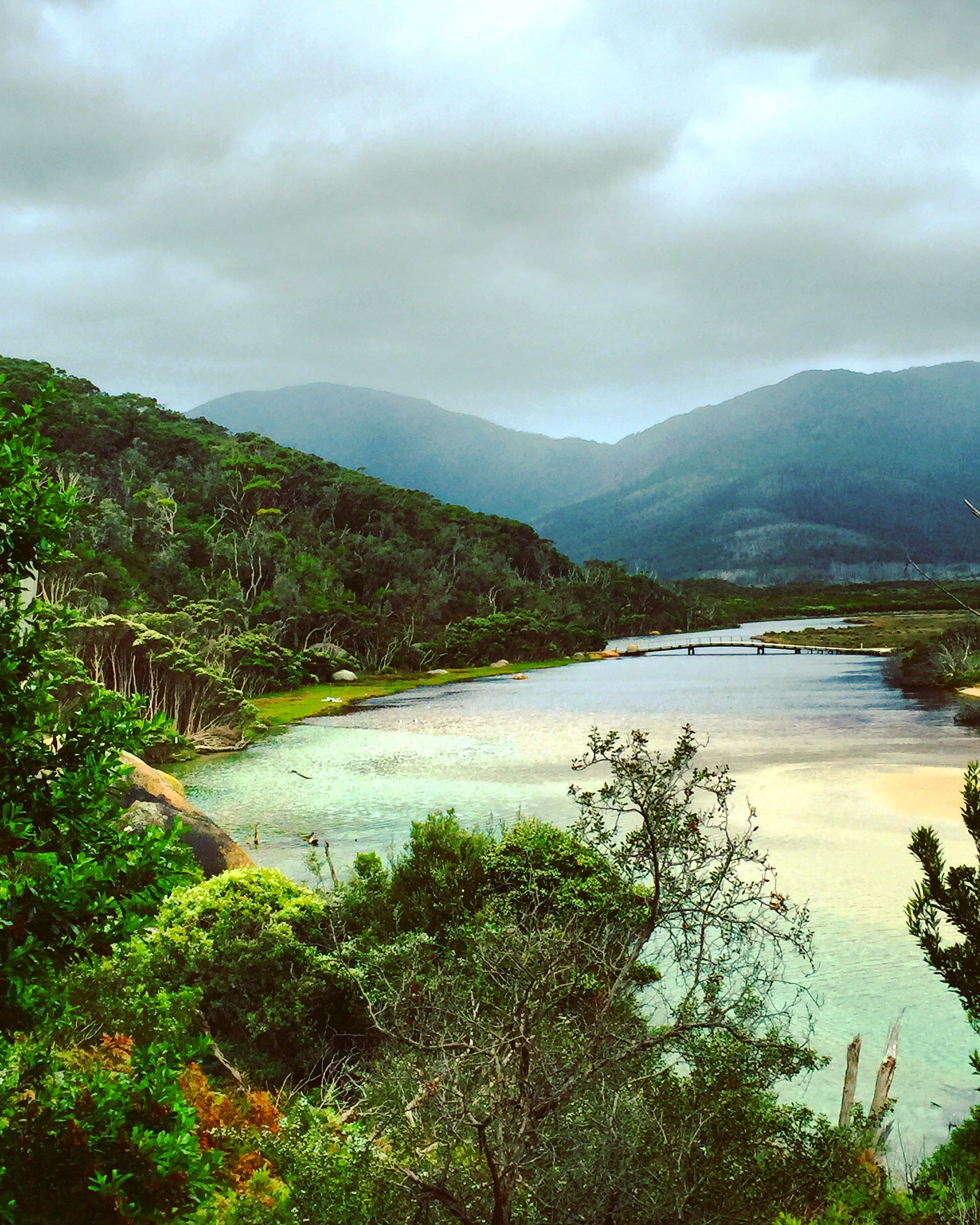
Yesterday I was able to get to Wilsons Promontory, a national park about three hours away. The hiking and views were amazing (though it was overcast and windy).
One of the views from the top of Mt. BishopTop of Mt. Bishop looking down at Squeaky Beach. it was so windy there was no chance of me standingComing around Tidal River was like a fairytale!