Kilimanjaro – A day by day account of the Machame route

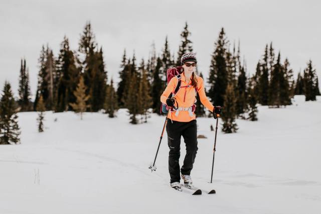
I wasn’t quite sure what to expect when I signed up to do Kilimanjaro. It was some interest in the climb, some FOMO. I dove into research – what temperature should I expect? Rain? Snow? How hard would the hiking be? I didn’t find the answers to all my questions, but by the time we arrived in Tanzania – I was ready. What follows is a recap of my experience – probably written a little like what I was looking for but unable to find with photos by my incredibly talented boyfriend Chris – make sure you follow him on Instagram and check out his website.

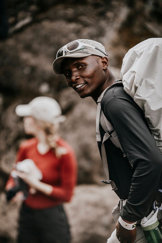
Jerald picked us up at the airport – we would later learn that he would be our head guide and by the end of the trip, he would be our friend. In the interim, he would pose as motivator, cheerleader, consoler, spiritual guide, doctor, healer, and leader. Jerald was the most impactful person I met on this trip, which I hope will be even partially described in the words to come.

IMG_1074
Jerald – our guide and mountain guru – Photo by Chris Bennett Photo

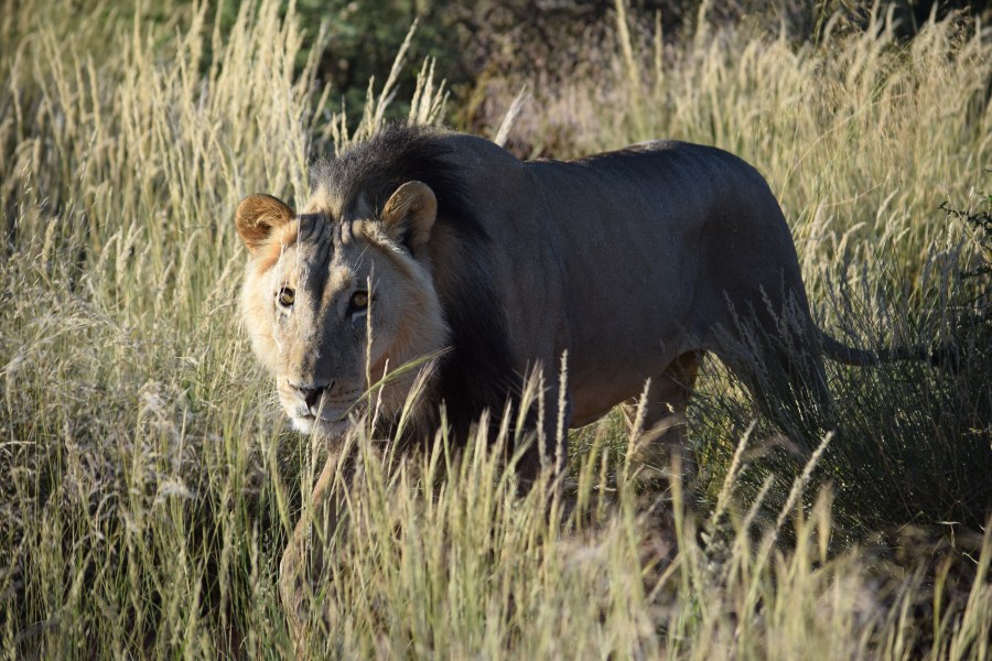
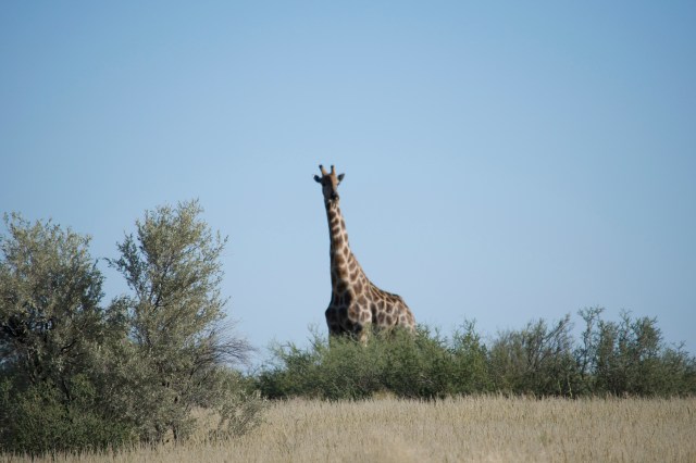
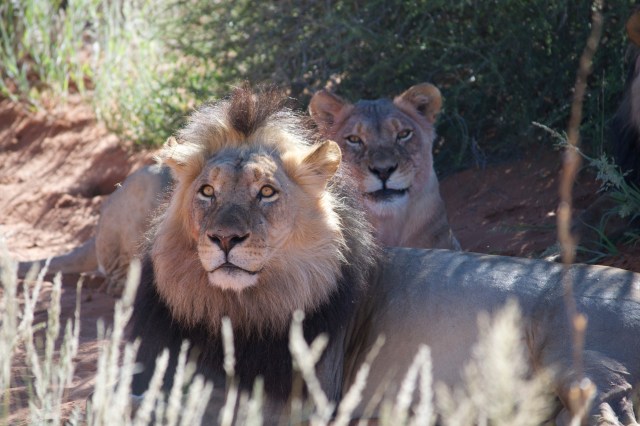
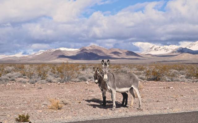
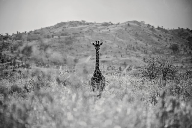
We had a day before climbing – so we opted for a safari at Arusha National Park. We were lucky enough to see giraffe, hippos, cape buffalo and zebra among other animals!


IMG_0780
Photo by Chris Bennett Photo


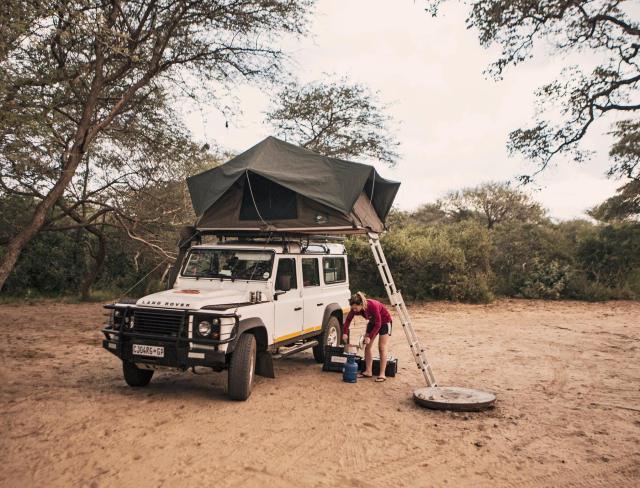
Day 1 – 2/27/2018 (5,400 – 9,400 ft): We left the hotel and made our way to Machame gate. This was our starting point for the Machame Route. I thought we would have to stand in a long line and have all our bags with us to get weighed. Turned out – we didn’t! The porters pack everything into larger bags and take care of that part. We simply had to sign in at the gate and we were good to go!

IMG_5823
Group shot at the gate with our guide Jerald – Photo by Chris Bennett Photo

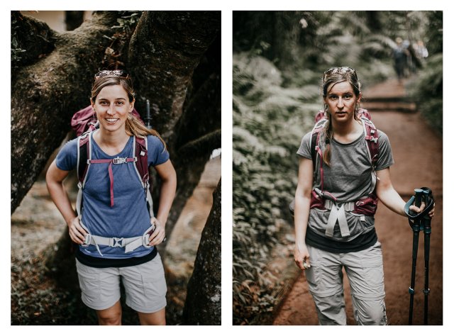
The trek was an easy walk – steady incline to 9,400 feet. It was through the rainforest and along a well-maintained trail. We stopped part way up for a boxed lunch. The 11k hike to our first camp – Machame camp was a rain-free, warm start to the trip!

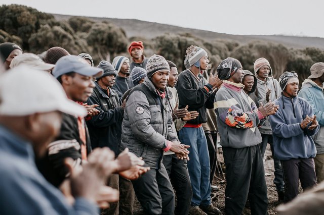
Once at Machame camp, we signed in at the register and were happy to see our campsite was set up with a great view of the summit and a nearly full moon. The summit looked so far away. The porters were superheroes and superhuman. They literally ran up the mountain with packs on their back and baskets on their heads – carrying everything from our sleeping bags, tents, and clothing to our food and our toilet (in addition to their personal things)!

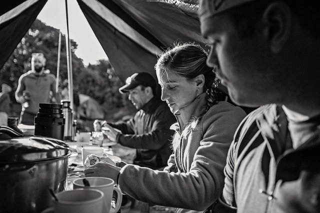
Jerald joined us in the mess tent for our meals – and during this time we continued to bond with him, asking about what we were to expect, about family and about life in general. He knows so much about Kilimanjaro and the surrounding areas – having been born and raised nearby.

As for the food – it was amazing. Almost every lunch and dinner started with delicious soup – from fresh tomato and ginger to creamy cucumber. Meals included everything from porridge, sausage, and eggs for breakfast to rice, veggies, sandwiches, and sauces to pasta and chicken for lunch and dinner. It was hard to believe that all this food was carried up the mountain to each camp – and then cooked and served to us hot. We were provided with tea, coffee and hot chocolate and popcorn in the afternoons.

IMG_6026
Photo by Chris Bennett Photo

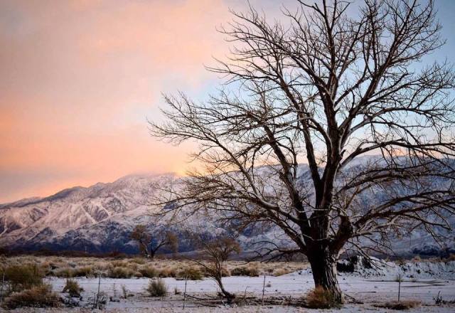
Day 2 – 2/28/2018 (9,400 – 12,500 ft): Trekking a similar distance as Day 1, we made our way up to Shira Camp. We went from the rainforest to the moorlands – and were lucky enough to have a clear to overcast day of walking – as we were no longer in the trees. I was surprised at the ease of the hike. Coming from the east coast, I am used to somewhat challenging and/or strenuous hikes. This, so far, had not been the case. Once at camp (again, with our tents already set up), we were lucky enough to experience some hail! As the sunset, the sky cleared and we got some incredible views.

IMG_6408
Photo by Chris Bennett Photo

I had felt really good until just before dinner. I started feeling a little nauseous, completely lost my appetite and had a slight headache. Jerald picked up on my discomfort right away and put me at ease. I had let some anxiety set in – I didn’t want to have to turn around – but I felt like absolute shit. Jerald spoke in such a soothing and comforting tone that my anxiety was soon washed away. Some of the group had been taking Diamox since before we started climbing. I had opted to wait until I felt the effects of the altitude. This was my sign (and Jerald’s recommendation) to start – so I took some Advil and my Diamox and went to sleep.

Day 3 – 3/1/2018 (12,500 – 13,000 ft): I woke up feeling much better – ate a hearty and delicious breakfast and we started on our climb. While we only increased 500 feet day over day, we climbed to a high of 15,000 feet to eat lunch at Lava Tower. The climb to lava tower was our first taste of real climbing – as we could see our destination in the distance, but because we were going ‘pole-pole'(slow, slow) and the altitude was starting to affect people, it seemed to take forever to get there. Our guides had set up the mess tent and toilet so we could have a relaxing lunch before heading back down to Barranco camp at 13,000 feet. The rainy season starts in March, and it sure is on time. We joke that we are on Africa time (nothing happens on-time – everything runs late), but the rainy season sure arrived on time for us. We had the most incredible thunderstorms overnight. I was most thankful for earplugs!

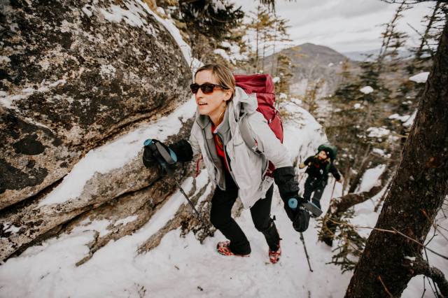
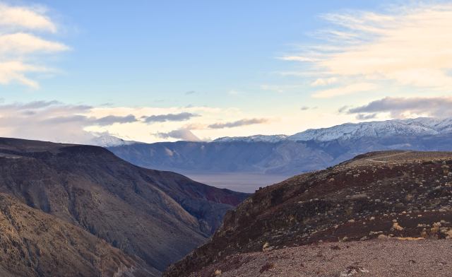
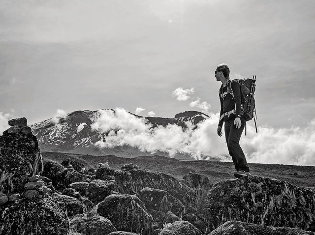
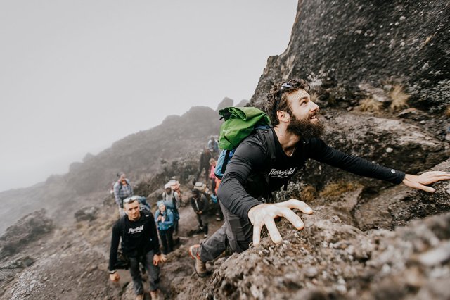
Day 4 – 3/2/2018 (13,000 – 13,100 ft): While this was a relatively short day for acclimatization, it was one of the more fun days. When we awoke – we were able to see the Barranco Wall (which had been in fog the night before). I would have had no idea that was the trail until I saw a little red dot about halfway up. It looked like the porter was rockclimbing – the wall appeared to go straight up, and none of us could believe that we would be going up that! The rain had lifted and traversing the wall included some scrambling and some minor climbing. It was a lot of fun – a nice reprieve from the walking we had been doing for the past 3 days. We arrived at Karanga camp for the night in time for lunch – which led to some nice naps that afternoon. The sunset and views were incredible – with the summit on one side and a view of Mt. Meru in the distance on the other. Again, the rainy season made itself known that night – with more incredible thunder and lightning storms overnight.

IMG_6696
Barranco Wall – Photo by Chris Bennett Photo
IMG_1338
Karanga Camp with Mt. Meru in the background – Photo by Chris Bennett Photo

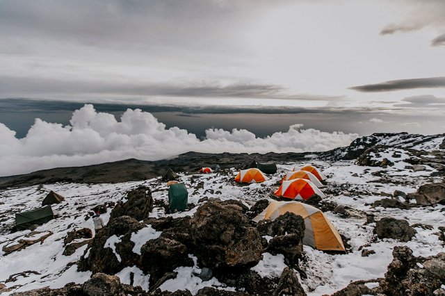
Day 5 – 3/3/2018 (13,100 – 15,300 ft): When we awoke and started our trek to Barafu camp for the day, we were surprised that we could see a snow line close to camp. This was a somewhat short day, but interesting as we neared the base camp. After dipping into a valley and back up, we were treated to porters and guides taking photos of the snow at camp. There was enough snow that they had to shovel out areas for the tents to go. Jerald told us this was the second time he had seen snow that low in the 9 years and over 250 climbs of Kilimanjaro he had done. To make matters more interesting, a number of the groups we saw coming down told us that they had to turn around – that their guides said it wasn’t safe to proceed to the summit in 2-3 foot snow drifts and blizzard conditions. We had an early dinner, grilled Jerald about what to expect, and tried to get some sleep before our 11pm wake-up call.

IMG_6996
Barafu Camp – Covered in Snow – Photo by Chris Bennett Photo

Day 6 – 3/4/2018 (15,300 – 19,341 – 12,530 ft): This was it. I was able to sleep a little bit and awoke just before our wake up call at 11 pm. Yes, PM. After a quick cup of tea and a few biscuits, we began our arduous climb towards the summit. This was the most mentally challenging thing I have ever done. The steps we took were so slow that we needed to have enough layers on to stay warm (as our body movements were not big or fast enough to generate extra heat). Our steps were slow because it took every shred of energy we had to move forward with the lack of oxygen. I felt far better than I thought I would though. I was expecting a headache and nausea – but luckily didn’t feel either. Other than feeling short of breath – I felt fantastic. The shortness of breath reminded me of how I felt when I had the symptoms of Graves Disease – having to stop frequently to catch my breath. As I think back now, I have to lean towards the Graves Disease helping prepare me for this lack of oxygen and inability to get a deep breath in.

IMG_7032
Hiking at night – Photo by Chris Bennett Photo

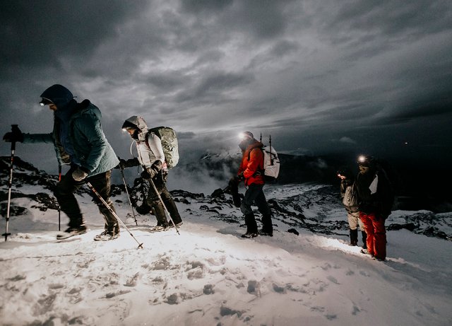
Had conditions been normal, we would have summited for sunrise. However, as we trekked through more snow, it took us nearly 10.5 hours to reach the top instead of the expected 6.5. By the time the sun rose, I could see the summit, but I was still over an hour away – it made for one of the longest hours of my life. Throughout the night, I tried to keep my mind busy by looking at the imprints that the shoes left behind in the snow. Each imprint, when crossed with another imprint, appeared as something else to me: a bicycle, bears, people cheers-ing steins – it turned into a game for me – that helped me take each step forward. Jerald and the assistant guides were imperative here. Their guidance was absolutely incredible. Sometimes they would just sing – and that was all that was needed to keep us moving forward. They knew when someone needed assistance, when someone needed encouragement, and when someone needed to make a difficult decision for themselves. Altitude is no small issue and there is no rhyme or reason as to how or when it affects individuals. It affected everyone differently on this trip, and I consider myself extremely lucky for the low impact it had on me.

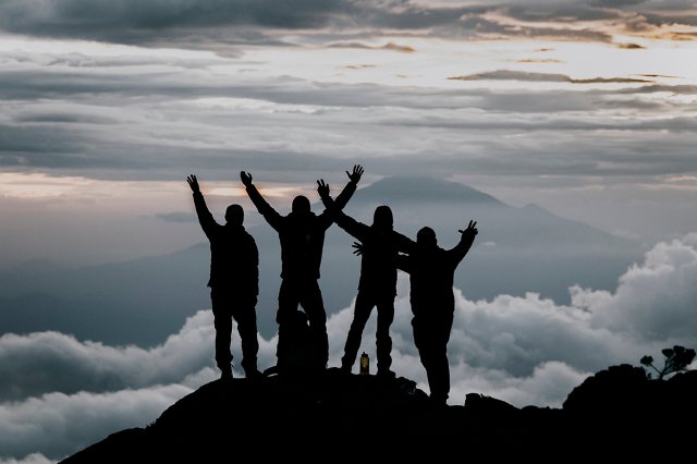
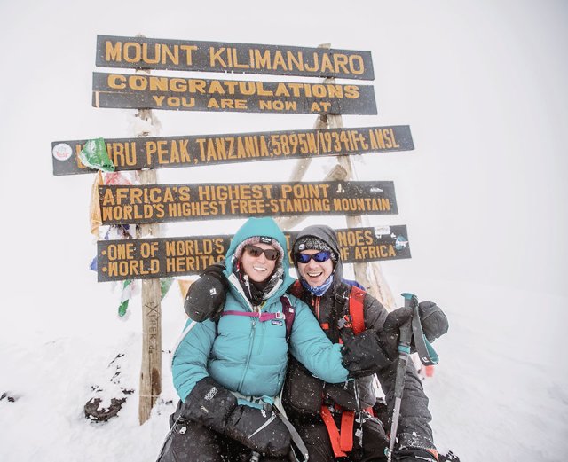
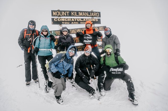
By the time I reached Stella Point (18,600 ft) I was beat. It took everything I had to make it to the sign. It was snowy, cold and windy – but I had made it – and the sense of accomplishment and relief was washing over me. I was one of the last in my group to summit – and it was incredible to see those behind me summit as well. I was ready to call it quits – I didn’t need to get to Uhuru Peak, I was happy with Stella Point. I was exhausted, thirsty and needed to pee. There is no private place for a girl to pee when it’s snowing leading up to and on the summit, so I was holding it. Therefore, I didn’t want to drink any water (silly me). Thankfully, another girl in the group gave me the push I needed to head towards Uhuru Peak (the summit at 19,341 ft). What we thought would be a quick jaunt to Uhuru Peak turned into an hour long, snow-covered traverse. I thought I had nothing left in me when I made it to Stella Point – making it to Uhuru took the cake.  While we didn’t have any views at the summit because of whiteout conditions, the experience made it all worth it. Not only did we summit Kilimanjaro, we summited in extreme conditions. But hey, we’re from Maine, so we’re used to extreme conditions :).

IMG_7387
Me and Chris at the summit! Photo by Chris Bennett Photo
IMG_7409
Our incredible group – Photo by Chris Bennett Photo

The trek down was almost as daunting as the climb up. I was mentally prepared for knee pain, I was not prepared for the sauna and sun reflection off the snow. We went from what felt like extreme cold on the summit, to extreme heat just below the summit. As the sun had risen, it reflected off the snow on the way down and created an oven – an oven that even Jerald said was extremely abnormal (if you haven’t caught on yet, we truly had an experience with abnormal and extreme weather conditions). I finally found a spot to pee – so was able to rehydrate and rush down the almost unbearable heat and sun. Rushing I say loosely – as it’s still hard to breathe – but every step down it became easier and easier.

We made it back to basecamp – had a quick rest and then headed down to Millenium camp for the night. We were supposed to have another 4 hours of hiking down to Mweka camp, but because summiting took over 10 hours, we opted to get to a higher camp during daylight and have a longer day hiking tomorrow. Getting to Millenium camp was no simple feat either. The trail ran through a wind tunnel – that we were getting pelted with rain through. We moved faster than I thought would have been possible after the night before. Many of us were going on no sleep – and I’m sure we were all running on pure adrenaline.

We arrived at Millenium Camp to the tents set up (did I mention the porters were superhuman?) and almost immediately passed out. We were awoken around 1030 for dinner  – at least those of us who actually woke up. While we didn’t need to eat, the food had been brought to the other camp, so a porter had to run down and bring the food back up to Millenium camp (hence the late dinner). For that, I felt obligated to get up and have a delicious dinner. Shortly after that, we went back to our tents, and I’m sure could have slept through a tornado if one had come through.

Day 7 – 3/5/2018 (12,530 – 5,400 ft): We were all ready to be off Kilimanjaro at this point. At breakfast, we organized the money that we were tipping to our porters and guides, and were treated to some traditional Kilimanjaro singing by our team. Jerald then asked for the envelopes with the tip money and announced to everyone exactly what we had tipped them. This public announcement of what we tipped was not expected (I’m happy we tipped well), and they broke out into another song for us. In the US, this is often a private matter, so we were all surprised that this was done so publically. Thankfully, we had asked Jerald what was considered good for tipping – and tipped more than that. I wish we could have tipped more – the team we had supporting us became family – an integral part of the success for us, but we had all brought limited cash with us on the trip.

IMG_1469
The incredible porters and guides singing for us – Photo by Chris Bennett Photo

We made it to Mweka Gate about 4 hours later and signed the exit registry. We had done it – we climbed Kilimanjaro.

Amy
You could say the hike took a lot out of me – before starting on the left and our last day on the right. Photos by Chris Bennett Photo

Before making it back to the hotel, we stopped in Moshi for a quick lunch and to see the shops. While we ate well on the mountain, there is nothing like a burger and fries and fresh iced tea to really soothe the weathered soul – and we got that at Chrissburger.

We all ate well and rested well that night before starting the 20-hour trip back to the states. We apparently brought the snow with us, as we arrived in Boston and followed the start of a noreaster back to Maine.

Overall, this was an absolutely incredible experience. I knew I was getting into both a physical and mental challenge – but I never knew what I would feel. Over a week has passed since we summited, and I am still struck by the experience in ways that I cannot describe.

**You will see the Flowfold logo a lot in these photos – Flowfold is an awesome local outdoor gear company (run by a friend and person climbing with us) that we were doing some product testing for. Check them out online and on Instagram!

The Grave(s) Road to Kilimanjaro

This summer, I made the decision to hike Kilimanjaro. I paid and started training for the hike that I’m thankfully leaving for in 2 days. However, in the months following booking the trip, though training hard, my stamina and endurance seemed to be getting worse, instead of better.

I was having trouble walking up the stairs to my office. Simple, 3-hour hikes turned into 5 1/2 exhaustive hauls with constant stopping to cool down and slow my heart rate. One of the guys going on the trip said he could see steam coming off my back on an early-December hike only 200 feet into the trail.  I was trying to wait until my appointment for a physical that I had scheduled for January. Unfortunately, while trying to get some altitude training out in Colorado, I hit a point where I needed to go see a doctor – and it couldn’t wait until January.

On December 22nd, 2 months before I was supposed to hike Kilimanjaro, I was diagnosed with Graves’ Disease and given a 50% chance of hiking. A common cause of hyperthyroidism, Graves’ Disease causes shortness of breath, increased heart rate, intolerance to heat, hand tremors and muscle weakness – all of which would hinder my ability to hike. I think it all started around the time and was the cause of me passing out at a Thievery Corporation show at Aura in September. I had felt excessively warm, and couldn’t believe that people around me were still wearing jackets – I was drenched in sweat. I turned to Chris – told him I was going to drop – and dropped – right in front of the stage (that was embarrassing). When I came to, the cop had already called the ambulance, and could thankfully see that I was not drunk or strung out on drugs (I was probably the most sober person there)!

25358336_10102618257912195_7394295101395962520_o
Rabbit Ears Pass in Steamboat Springs, CO.What this picture from mid-December neglects to show is that I’m sweating and it’s around 5 degrees outside (and not putting any effort into skiing). I was down to a sports bra about 5 minutes after this. Photo by Chris Bennett Photography
My thyroid levels were off the charts. My doctor told me that I needed to stop all excessive physical activity until they were under control as I ran the risk of cardiac arrest. I went into a Google frenzy, reading about recovery times, buying travel insurance and trying to figure out my chances of actually hiking and what I could do to increase those chances. Most message boards had people saying it took 3-6 months for them to begin feeling normal again. I had 2 months to my hike.

After a few weeks taking 8 pills a day (six 10mg pills of methimazole and two 10mg pills of propranolol), I was starting to feel a little better, so I started up again with some training hikes. They were slow going to keep my heart rate down and I was often in a tank top or sports bra – but I was finally starting to feel better. Every two weeks I had my blood tested and my doctor would tell me to cut my meds – from 6, to 4 and to the current number of 2.
26962526_10102670637358365_2182501610672134890_o
I was in a sports bra about 10 minutes prior to this. Whiteface Mtn. in NH – Photo by Chris Bennett Photography
6 weeks after the initial diagnosis my endocrinologist gave me the clear to climb. While that has only given me a couple weeks to really train, I’m confident enough in my physical abilities at this point for this type of climb. Huge thanks to Dr. Brodsky at Maine Medical Partners Diabetes & Endocrinology for understanding my goal and providing and opting for an aggressive treatment! And while we don’t know what causes Graves’ Disease and it will likely be something I have to deal with for the rest of my life, but now knowing, and keeping my thyroid in-check will allow for more adventure and travels!


325 days, 13 countries, 65,000+ miles

My first retirement is over.

325 days ago I left a great job to spend time exploring the world. What I thought would be between 3 and 6 months turned into almost a full year – and an experience of a lifetime. Now, I have found a new career with Energy Circle – creating digital marketing plans for companies & organizations that work to build and outfit efficient and healthy buildings. It’s a bittersweet ending to an incredible year – as I would love to keep traveling (and will continue to some extent), but like all things, traveling costs money so I need to pay the bills…until my next retirement 🙂

So now, a full wrap-up, reflections and thoughts about this past year:

  • 325 days (June 17, 2016 – May 7, 2017)
  • 4 continents (North America, Europe, Oceania (Australia), Africa)
  • 13 countries (US, Canada, Sweden, Denmark, Germany, Italy, France, Australia, New Zealand, South Africa, Namibia, Botswana, UK)
  • 28 states (Maine, New Hampshire, Massachusetts, Connecticut, New York, New Jersey, Pennsylvania, Ohio, Indiana, Illinois, Iowa, South Dakota, Wyoming, Montana, Idaho, Washington, Oregon, California, Nevada, Arizona, Utah, Colorado, Kansas, Missouri, West Virginia, Kentucky, Virginia and Maryland.)
  • 14,000+ miles of road trips (doesn’t include every day driving while home)
  • 65,000+ miles of total travel (estimate including air travel)
  • 9,500+ photos (some better than others)
IMG_5178
My Instagram feed of photos since I began traveling back in June 2016

Favorites:

  • Country: New Zealand. When someone asks what my favorite place has been there is no question, and no hesitation when I answer, New Zealand. From the people to the geological features, New Zealand was absolutely incredible. Africa would also go on my favorites list, but it still doesn’t come close to how much I loved New Zealand.
  • State: Utah – I would have loved to spend more time in Utah – specifically the Moab area!
  • Activity: Bungee Jumping. Such a rush (and surprise! I did it in New Zealand) as well as hiking all over!
  • Airport: Heathrow, London. This may be just because there were clean showers that were welcome between 10+ hour flights!
  • Border Crossing/Immigration: Dobe border crossing from Botswana into Namibia. We had to track down officials for both countries to get our passports stamped! The border was so remote that they only get one car every 2-3 days!

Least Favorites:

  • Country:  None. There was something amazing about every country I visited – and I would revisit every single one!
  • State: Again, I don’t know if I have a least favorite state!
  • Activity: Going to drug stores in Australia. Unfortunately I was sick through my entire travels in Australia so frequented the drug store to get medicine! They don’t sell over-the-counter cold medicine so I had to speak to a pharmacist every single time. Plus, they only provide around 4 days worth at a time, so I was going every 4 days!
  • Airport: LA. I didn’t have to go far within the airport, but it was crowded and my terminal didn’t have many options for grabbing a bite to eat!
  • Border Crossing/Immigration: Boston/Logan airport. I don’t think I spent less than an hour in this line in any of my travels this past year – and at one point the line was so long people couldn’t even get off the plane!

I learned so much during this time,  and if I were to share anything with you it would be that if you need a break, take it. Time away from the office, a desk, or your home can be extremely refreshing and give you greater perspective and a better idea of who you are. I hope that in another 5-6 years, I may be able to retire again for another year. My advice to everyone is to take risks, get outside your comfort zone and never stop traveling. Whether it’s across the globe or across your town – there is something new and exciting around every corner!

One word for Kruger National Park…GO.

Scroll to the bottom for all the good animal shots!

We left the Kalahari and began making our way towards Johannesburg. We stopped for the evening in a small town called Vanzylsrus. We pulled up to the Vanzylsrus Hotel, and after reading that reception was closed (outside of cities, hotels tended to close early on Sundays), we looked in and around the corner, and to our luck, we found the proprietor who set us up with a room that included dinner and breakfast. The hotel was really unique and quirky – almost hippie-ish and super artsy. The name, and theme of our room, was “Cunning Critters.” The owners were there and shared a wealth of information – especially on places to avoid stopping on our way through to Johannesburg as they preyed on tourists.

From there, we headed to Johannesburg and met Luan from SA 4×4 to get a new air filter put in and a spare in case it happened again. We then started heading towards Kruger! Unfortunately, we got off to a slow start as there was a bad accident that made the 6 lane highway essentially shut down. We made it to Sabie River Camp late that night, a little more than an hour from Kruger. We woke up the next morning and made our way to Kruger via the Panoramic Route and Blyde River Canyon. The views were absolutely stunning.

IMG_4557
Blyde River Canyon

We finally made it to Kruger – and it didn’t disappoint. We initially planned for two nights, but decided after we got in to stay 4 nights in various areas of the park. We finally saw the elephants we so desperately wanted to see – they would just come out of the bush where you were least expecting them too! We also saw many giraffe, zebras and impala. It was a magical place – we could sit for hours just watching the animals.

Keep scrolling down for the bulk of the animal photos!

We had another issue with the Defender… the rear door wouldn’t open. We tried everything, but because all the tools were in the drawer accessible only from the rear, we weren’t able to open it at all…which also meant the food we had bought we couldn’t get to either! We called Luan back and he said there was a shop in the park somewhere. We head there on day 2 and spend the entire morning and a good part of the afternoon there as they literally unhinged the door from the truck – and even then the latch was still jammed. Unfortunately they couldn’t fix it, but we were able to get the necessities out of the drawer. Because they “didn’t win,” they didn’t charge us for working on it. We did, however, tip them and make them sandwiches for lunch!

The animals at Kruger were really something special…vehicles didn’t really phase them a whole lot. It was a great way to end our journey through Africa!

We finished up at Kruger and stopped on our way back to Johannesburg at a Lodge we found in the GPS. As we were driving up.. we decided on a max we were willing to spend – as it looked like it was going to be pricey. Turns out, it was less than half of what we were expecting it to be! Staying at the Kloppenheim Estate, including dinner, drinks, breakfast and a little laundry, cost the two of us a total of $140. Based on the buildings, activities offered and gated entry way, we were expected it to be closer to $400. It was a beautiful place to relax and clean up before we started our 30+ hour trip back to the US.

17797507_10102195269244875_1730441112_o
Last day in Africa with the Defender. Chris Bennett Photo

So that’s all for Africa… and unfortunately wraps up my 11 or so months of travel around the world.

Luxury, lions and trouble with the Defender!

Please note.. there is an image of a lion’s meal towards the end of the post, so don’t scroll past the first couple lion pictures unless you want to see it!

We didn’t have far to go for our next stay. We decided it was time to treat ourselves to a luxury African lodge, which happened to be fairly close to Sossusvlei. We drove about an hour to Hoodia Lodge, and to our luck, they were able to accommodate us in one of their bungalows!  It was stunning. We were able to clean up, enjoy the pool and catch up with a little wifi (albeit slow). Photos by Chris Bennett.

It was a typical African Lodge where they come out and meet you with a cold beverage and then treat you like royalty, constantly checking to see if anything is needed or if they could do anything. We had some laundry done, as our clothing was starting to get a little stinky, and simply relaxed. We had been driving significant distances for the past week, so it was nice to unwind and relax.

Our next stopping point was towards Mata Mata – a border crossing into the Kalahari in South Africa. We decided to check out the Kalahari Game Lodge just before the border to South Africa, which offered both lodge facilities and camping, as well as a large lion reserve.  I had emailed the day before to check availability, as we were unsure if we would make it the whole way or not.

Maybe I jinxed us, but as we were driving, we had to cross a couple very large puddles (there was no avoiding them). A few minutes after going through, the engine slumped and we lost most of the power to the engine. We got out the satellite phone and called the rental company. They said try to get to the nearest town and find a garage, then call back. We were about 15 km from the smallest town, and we found a couple garages in the GPS. Going about 35 mph the whole way, we made it around 10:30, and since it was Saturday, one garage was closed and the other had to call in the guy who worked on diesel engines. He came, took it for a drive and said it was the fuel filter. He said he couldn’t help and for us to drive to the next town, a small city where they would have more options. We started making our way there and called the rental company back. They told us to find the Toyota fuel/service station and to ask the attendant where Christie lived. Apparently he lived nearby and they would know.

IMG_4486
After going through the water

We get to the fuel station and ask, and they direct us around the corner to Christie’s. He came right out and started taking apart the engine. He pulled out the air filter. The engine had essentially started eating the filter after it got wet. He cleaned it up with the air compressor, flipped it around, took the defender for a spin and we were off! Even better, we weren’t charged a thing. We got that sense throughout our travels – people in Africa are inherently kind – and not looking to make money at every instance!  It may sound like it was a seamless day, but it’s a little stressful when your car breaks down in the middle of nowhere and your satellite phone only works some of the time!

18051852_10101462753138145_1192553825_n
The engine ate the air filter

We did eventually make it the Kalahari Game Lodge, and when we arrived we opted for camping – as the sites were set up with individual eco-friendly bathrooms and washing stations. It was an impressive set up!

17758238_10102191716719165_6517598828489231840_o
Our camping set-up. The stars were insane! Chris Bennett Photo.

We signed up for a ride through the Lion reserve the next morning. All the ‘dangerous’ animals were kept in a large (read thousands of acres) area that was blocked off from the camping/lodging area for safety.

The next morning, we woke up early, layered on clothes (it was probably around 50 degrees, but after 100 degrees it felt like 20!) and headed out in the truck to find some lions. The excursion didn’t disappoint – we saw 1 female and 4 male lions. 3 of them were relaxing after a nice meal of orix, which we saw nearby. Also nearby was an enormous giraffe – the photo doesn’t do the size justice. If you don’t want to see the orix leftovers, only scroll through the next 4 photos, the 5th is a little graphic!

IMG_4505 2
The photographer
DSC_1147 2
The photo doesn’t do the size of this guy justice
DSC_1152 2
We got pretty close!
DSC_1127
Watching the lioness.
DSC_1138 2
They had just feasted.

After the tour, we decided to head towards Johannesburg, where we were going to meet the rental guy for a new air filter. From there, and in my next (and I think final Africa post) – on to Kruger National Park!

Desert, dunes and finally some animals!

Up until this point, our wildlife encounters had been limited to cows, donkeys and goats crossing, standing or laying in the road. As we drove into Etosha, we knew our luck was turning as a huge giraffe crossed the road just inside the gate. We got our permit at the gate and made our way into the park. After reserving our campsite, we started taking our time driving. Like most wildlife parks in Africa, we had to stay in our car in most areas – you never know what may be lurking in the tall grass!

We weren’t very far in when we noticed we were surrounded by zebra! We joked throughout the remainder of the trip that we thought the parks baited the entrance/exit gates as we saw more animals near those than within the park! Etosha was a fairly flat park, but we drove through and down roads to the different view points and pans. We stayed the night in the park – right next to a water hole, so were treated to seeing a couple rhinos at sunset!

From Etosha, we headed to Swakopmund – a city on the coast of Namibia that seemingly arises out of nowhere from the desert!

IMG_4354
The second time we crossed the Tropic of Capricorn!

We had some fun stopping in the middle of the desert road to have some fun with the Defender and also stopped to check out the items the Herero tribe women made and sold along the way to the Skeleton Coast (which is known for its many shipwrecks). Photos below are by Chris Bennett.

Swakopmund is a very German city that reminded me a lot of Nice, France. There was a promenade and pier and it seemed almost tropical. We opted to stay in a hotel to freshen up, and treated ourselves to pizza and skewers at a restaurant for dinner. I was expecting kebab style skewers… This was my surprise!

IMG_4338
100 grams each of rump, venison, Orix, Ostrich and Eland!
18053016_10102221666614335_1098729099_o
Hotel Balcony in Swakopmund! Chris Bennett Photo

From Swakopmund, we made our way to Sossusvlei, catching sunset at Dune 45 and spent the next day exploring the Deadvlei.

We left Sossusvlei sweaty and sandy. Next stop – a luxury African lodge!

Into the bush…the search for border officials (Africa Part 2)

Picking up where we left off, Chris and I had made the decision to head towards Namibia. We decided on a route that would take us through one of the most remote areas of Botswana, and one of the most, if not the most, remote border crossings into Namibia. Because of the remoteness, and not knowing where we could next fuel up, we filled up the three tanks of the Defender and the two jerry cans and started our way towards the Dobe border crossing.

The road was….challenging. Like most roads in Botswana, it was dirt, but because of all the rain they had gotten, it was washed out and slow-going. We probably averaged 30 mph for most of the 85 miles to the border. The road was bumpy and definitely required a 4×4. The Defender took on it’s first puddle (more like a pond), and after a quick stall and a skipped heartbeat, pulled itself out like a pro.

We knew the border would be quiet, but we didn’t realize we would have to search for the border officials. The official from Botswana saw us drive by and came running towards us shortly thereafter. We completed the required paperwork, got our exit stamps in our passports and then they opened the gate for us to leave. After the first gate, we had to get out, step on this pad with liquid on it as they sprayed our tires for foot and mouth. Then they opened the gate for Namibia and we drove through.

There was no gate to stop at once we were in Namibia, but knowing we needed stamps we stopped at the first building we saw and got out. The office doors were open, paperwork and stamps sitting out, but no one was in sight. Chris walked around back and after several minutes, found the police and immigration official. Chris sat down with the police and did the paperwork for the car and I sat with the immigration official to get the passports stamped. I had left my occupation blank by accident, so when he asked and I said I was unemployed, he looked at me confused. “I’m just traveling the world” I said… and his reply was “So…. housewife?”  Sure. I went with it because it would have been harder to explain. We asked them how many people they saw come through that border. One car…. every few days.

17434948_10102170560316765_6196299923473992249_o
Camping! Chris Bennett Photo

Once we got our stamps, the roads became much easier and we made our way to our first camp in Namibia in the Naye-Naye Concession Area, near local bushmen villages. Here, we met another couple who had rented a Land Cruiser from SA 4×4 and were traveling a reverse route to us and going from Cape Town to Nairobi. They were doing our trip, but on steroids. They actually made it to Zimbabwe and encountered the road blocks that we opted to avoid. Check their trip out at beyondboundaries.blog.

17435949_10102170559732935_7166355213977039399_o
Eric and Monika – en route to Nairobi! Chris Bennett Photo

From there we began working our way to the Atlantic. We stopped on our way at a local San Bushmen village, where they welcome visitors who make the drive down the 4 mile sand track to learn about their culture. It definitely was a highlight of the trip. Photos by Chris.

We made it to Roy’s Rest Camp that evening – which was quite the experience! Complete with a bathtub filling the swimming pool.

At this point, we realized our trip was turning around and getting a little more exciting. Botswana was unfortunately a bust, but we hope to go back in a drier time. The next stop would bring some wildlife…Etosha National Park, and some dead trees…Sossusvlei. More on that next week!

When it rains, it pours: Botswana, Police & Flooding (Africa Part 1)

Since internet was sporadic and unreliable while traveling in Africa, I’m going to break down the trip into three posts. First up – our travels through Botswana!

After 30 hours of travel, Chris and I landed in Johannesburg, South Africa and were picked up by the owner of South Africa 4×4 (the company we were renting the Land Rover Defender from). We chose SA 4×4 because a) they had Land Rover Defenders to rent that they allowed into multiple countries, b) they provided all the necessary camping gear and c) they had the best reviews online. When we got to the shop, the set-up was great. It was a 2014 Defender equipped with a tent on the roof, sound system, a couple jerry cans for extra fuel, sleeping bags, pillows, pots, pans – literally ALL the necessary camping gear, right down to seasoning and olive oil to get us started, and of course the breakdown & safety equipment – spare tire, jack, air compressor, tire plugs, GPS, satellite phone, first aid kit, and fire extinguisher. It was incredible how well-equipped the truck was. I also need to add…driving a manual transmission with your left hand while trying to pay attention to driving on the left side of the road is quite the challenge!!

17358565_10102166175573825_1539601034065263403_o
Our Defender set-up! Chris Bennett Photo

We left around 1 pm and began our journey towards Bostwana. Around 4 we started looking for places to camp. Our GPS and maps had camp sites listed, so we found one along our route and made our way there. We arrive at the gate but are unable to open it – there is no way to call the site so we end up turning around and looking for another camp site. About 10km down the pavement and about 2 miles down a dirt road we came to our second option, but decided to find another one when the entrance gate noted that it was a nudist area! Finally we got to a town and opted for a guesthouse. We drive up and are greeted by a woman and pay 500 rand (around $45 USD) to stay the night. It was a nice, quiet house that we had all to ourselves (guesthouses are popular in Africa and rent out individual rooms in a larger bunk house). As soon as our heads hit the pillows we were out.

IMG_4106
The nudist camping area!

The next day was our first border crossing – into Botswana. It took about an hour, and we had to get our passports stamped in South Africa first to leave, then cross into Botswana and go through immigration and customs there. Botswana was the only country where we had to pay a customs charge to enter (around $13 USD). Our first night camping was at Khama Rhino Sanctuary. We arrive, set up camp in a hurry and are almost immediately down-poured on. It was an impressive thunder and lightning storm – the sky lighting up constantly and thunder booming so loud we could hardly hear ourselves think. The tent held up surprisingly well – we stayed completely dry throughout the torrential downpours. We did have a couple visitors in the night that we heard scurrying around… one a warthog and the other was likely some sort of wild dog. The following day was spent driving around the Rhino Sanctuary – the Defender did wonderfully –  made the 4×4 requirement feel like a piece of cake! The rhinos were a ways off the road so were hard to see, but there were hundreds of zebra, ostriches, a giraffe, springbok and more!

Our plan was to make our way through the parks in Botswana – the Makgadikgadi Pans, Okavango Delta and up to Chobe National Park and then up to Victoria Falls in Zimbabwe. Unfortunately, at every site we stopped at our plans were thwarted with talk of flooding, closed parks and impassible roads. The amount of rain Botswana received this year was unprecedented, and we couldn’t have planned for it – as no one knew anything about other parks and websites didn’t provide updated information. We had to go to these places to learn they were closed or nearly impassible.

On our route to one of the closed areas, just outside the entrance to a diamond mine, we were ‘hailed’ over for speeding. Literally, the police had a camera set up and would run into the road and wave you down when you got close to them. We had to pay the fine on the spot (about 400 Bostwana Pula). We only had South African Rand, so the officer did a ‘guess-timate’ in his head and settled on 500 Rand (about $40 USD). It ended up being a fairly entertaining stop – the officers were friendly, helpful, and we chatted with them for a bit about our travels. They were the second people who said to be cautious if going to Zimbabwe, as in addition to constant and unnecessary road blocks, the police will pull you over and fine you on the spot for silly things – like your tire pressure being too low or your car being too dirty.

Needless to say, we were feeling a little defeated and very stir crazy. We had been in the car for 4 days and not seen a whole lot because of all the closures. We didn’t want to get to Zimbabwe and be even more annoyed by the hassle from the cops, so we decided to head west instead and go into Namibia.

Road Trip through Southern Africa

The only traveling I’ve done in the last two weeks has been moving from my brother’s house in Windham to my own apartment in Freeport. But, in that same time, I’ve been planning what I think will be my final trip of this almost year-long adventure – a trip to southern Africa.

I didn’t think this trip was actually going to happen, but the stars aligned and when I got a notification that flight prices dropped, Chris and I decided to just book it. We’ll be flying into Johannesburg, South Africa, picking up our Land Rover Defender (equipped with camping equipment) and setting off on our journey on March 14th (returning April 4th).

xklusiv204

Our first stop was travel medicine. Most travel medicine places were booking out past the day we were leaving. After calling around to a number of places, I finally found someone who could get us in. I’ve started the typhoid and malaria regimen to be on the safe side, and because we aren’t traveling to any yellow fever areas (though we’re coming close), we didn’t have to get that vaccination.

Our plans are fluid at this time, but we hope to visit Namibia, Botswana, Zimbabwe, Mozambique and of course, South Africa. We’ll explore the deserts, wildlife areas, Victoria Falls, and I’ll hopefully get to go scuba diving (as long as I don’t get another nasty head cold)!

Our want-to-see list includes:

  • Kgalagadi Tranfrontier Park

    29cead_91561710b3524537b24327a2d824a973mv2
    Victoria Falls
  • Okavango Delta
  • Chobe National Park
  • Makgadikgadi Pans National Park
  • Victoria Falls
  • Lake Kariba
  • Chimanimani District
  • Nyanga National Park
  • Hwange National Park
  • Blyde River Canyon
  • Kruger National Park
  • Tofo Beach

    panarama-route
    The Panoramic Route/Blyde River Canyon
  • Sossusvlei
  • Skeleton Coast
  • Etosha National Park

Internet will likely be limited, but I will try to share as much as possible!

Road Trip Wrap Up

I know, I’m a little late on this post. I’ve been home for a little over a week so I figured it was time to share the latter half of my road trip!

Last known location was Washington, I had made it. The next few days did not go as planned because my good luck with good weather took a turn.

16652690_10101389370801935_1244001805_n
Packed my sister’s life into my car! Ready to hit the road.

My sister and I got a late start leaving Washington so we had to pass by Multnomah Falls. We were on our way to Crater Lake National Park. But wait! Avalanches in Crater Lake NP? Made the trip impossible for us unfortunately. While staying a night in Oregon, I stopped by Jeep service to check on a tire that had low tire pressure. Apparently a sharp rock had punctured the tread, so after a quick repair we were on our way again! We continued on down to Berkeley, CA to stay with one of my sisters friends for a couple days.

We arrived for dinner and the following day did a little hike in the hills before the rain started. That evening, we participated in the Women’s March in San Francisco (the day after Inauguration Day). It was a really incredible experience – completely peaceful and invigorating at the same time. The rain only dampened our clothes and some signs, but walking through downtown San Fran with over 100,000 others is not something I’m going to forget!

16558494_10101389370786965_1271728146_n
Women’s March in San Francisco

Our next stop was supposed to be Big Sur. But alas, land and mudslides closed the road. So scratch that. Let’s go to Yosemite! Oh wait, road closed due to snow. Ok.. how about Sequoia to the south… trees down so roads closed there!

Well, I guess we’re going around to Death Valley then! I’m really glad we did too – it was amazing. We had a little snow as we headed in and the valley itself was beautiful. My sister trapped a scorpion in the general store because the employees there were too afraid to capture it.

16559414_10101389370921695_1504401907_n
Sunrise after a snow in Lone Pine, CA as we started our drive into Death Valley
16388620_10101382825912945_596672399_o
Pass Overlook as we neared Death Valley
16521552_10101389370771995_968458940_n
Death Valley – there has been so much rain that there were areas in the basin that were actually flooded
16558441_10101389374379765_847532548_n
Scorpion! The second I have seen on my travels this year

We went out the other side of Death Valley and were welcomed by a herd of Donkeys! We made a quick pit stop in Vegas to top of the fluids in my Jeep and continued on to Utah. We had an evening drive through a snow storm in Zion and stayed the night just outside of Bryce Canyon National Park.

16389376_10101382789810295_2030775230_o
Two of about 15 donkeys welcoming us to Nevada

Early the next morning we worked our way into Bryce to Sunrise Point. It was frigid and early, but totally worth it.

16652454_10101389370856825_1287165336_n
Bryce Canyon National Park sunrise
16466124_10101382826357055_1407018814_o-1
Bryce Canyon

From there we took the back roads up Boulder Pass and through Capitol Reef National Park. It was another stunning park!

16558984_10101389378636235_1586222110_n
Capitol Reef National Park

We finished up the day visiting both Canyonlands National Park and Arches National Park. We hiked out to Delicate Arch at Arches for sunset – it was spectacular.

16522776_10101389370876785_1489240906_n
Canyonlands National Park
16522533_10101389370831875_1742731883_n
Sunset at Delicate Arch
16651743_10101389378760985_92628717_n
Balanced Rock at Arches National Park

The next two days were strictly road days. We spent 14+ hours each day in the car moving across the mid-west. We made a short stop to do a quick mile and a half hike on the second day because we were so tired of being in the car. When we made it to Virginia we spent the morning doing the upper section of the Blue Ridge Parkway. I think we passed one other car on the entire parkway!

I dropped my sister off in Maryland and made my way home to Maine that evening. All in all, an 8,850 mile road trip in 16 days. I wish I had more time to spend in Utah, and I wish we could have gotten to the closed parks, but there is always more time to visit in the future.